

First Atlantic tropical disturbance of 2024 no longer monitored by National Hurricane Center
MIAMI, Fla. - More than 30 days out from the official start of the Atlantic hurricane season, the National Hurricane Center (NHC) tracked the first feature of the year. However, like many off-season developments, it was just a meteorological wonder.
The NHC gave the area of low pressure, which was more than 1,000 miles off the African coast, just a 10% chance of development on Wednesday and said its window for organization would likely end on Thursday.
The FOX Forecast Center said the area of low pressure broke away from a frontal boundary to become its own unique feature in the open Atlantic.
Due to the position of the area of low pressure, the disturbance was simply a marine interest until upper-level winds sheared away thunderstorm activity on Thursday.
NOAA warned the system was producing wind gusts of about 35 mph, and seas were reported to be 11-14 feet in the vicinity of thunderstorms.
Satellite imagery showed the swirl diving to the southwest Wednesday ahead of the unfavorable conditions that developed.
Elsewhere around the Atlantic Basin, computer forecast models show no development of tropical cyclones through at least the first week of May.
RELATED: How the fading El Nino pattern will impact hurricane season activity in 2024
The Pacific Ocean is usually the first basin in the Western Hemisphere to see tropical cyclone formation during the year, but there, too, conditions look status quo for the next several weeks.
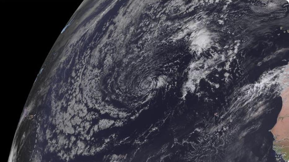
This satellite image shows the area of disturbed weather in the Atlantic Ocean on Thursday, April 25, 2024. Credit: NOAA.
The development of an off-season cyclone does not guarantee that a year will be extremely busy. However, coupled with an active hurricane outlook released by Colorado State University (CSU), it puts weight behind the idea that 2024 could be a banner year.
STAY CONNECTED: Download the free FOX 13 News app for Live SkyTower Radar, forecast videos, and more weather coverage
The CSU team is calling for 23 named storms, with 11 that are expected to become hurricanes and five that could reach major hurricane status, with winds of at least 111 mph.
Forecasters noted that the outlook was the largest prediction for named storms that CSU has ever issued.
READ: Hurricane names 2024: Here’s why the list may look familiar
In the Atlantic Basin, the tropical cyclone season begins June 1, with the average first development happening about June 20. The first tropical storm of the 2024 season will earn the name of Alberto.
SIGN UP: Click here to sign up for the FOX 13 daily newsletter