

USGS water sensors capture lifesaving data in real-time during hurricanes
TAMPA, Fla. - The United States Geological Survey (USGS) is collecting potentially lifesaving data about storm surge levels.
USGS technicians deployed more than 250 water levels sensors along Florida’s gulf coast, from Panama City to south of Fort Myers before Hurricane Ian made landfall.
"I would say storm surge is one of the most severe impacts of a hurricane," USGS Hydrologic Technician Don Hampton said. "I mean, from Ian, we've seen it's deadly. It's very powerful, very destructive."
Hampton said the different types of sensors are able to capture data on the height and length of time of storm surge.
Hundreds of water levels sensors were placed along Floridas gulf coast. Courtesy: USGS
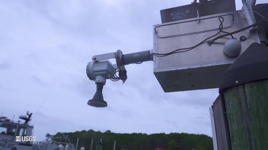
"So we have some sensors that go on dock pilings, bridge pilings," Hampton explained. "We have some that go on bridges, that measure the water from above, and we have some that go on the barrier islands and the dunes and beaches."
He said some of the storm tide sensors stationed above water.
"It's designed to be quickly deployed on a structure in the path of the hurricane," he said. "What is really significant about this one, is it can actually measure, record and transmit the storm tide data live during the hurricane."
During hurricanes, the sensors record lifesaving data.
Hampton said the USGS emergency responders and even people at home, are able to track the data in real time through the USGS.
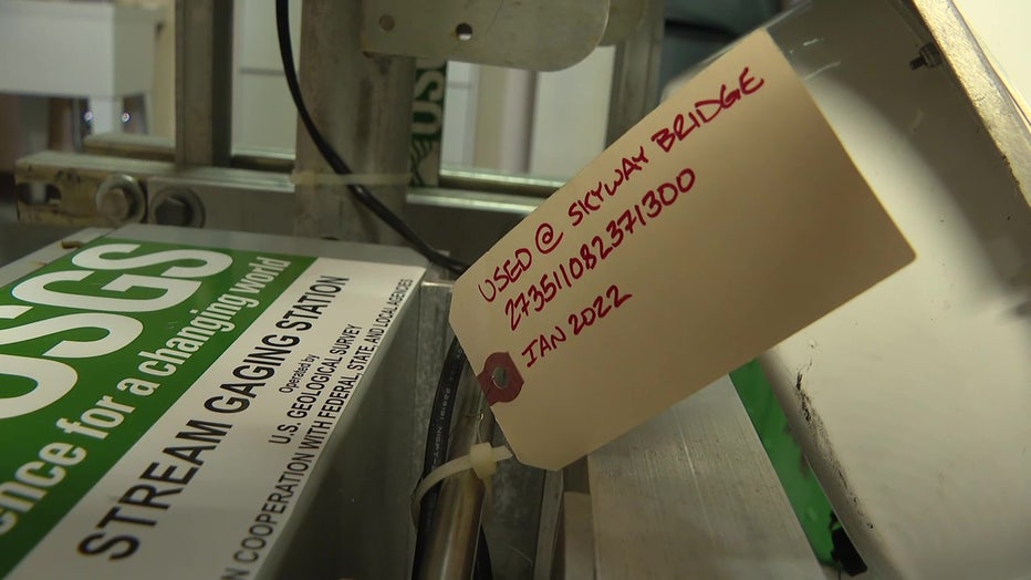
Some of the other sensors record data from underwater. Hampton said they’re not able to collect this data until after the storm passes.
"So we'll mount that into our bracket there on the piling, and this is our vented housing that will protect it during the storm, and this will record every 30 seconds," explained Hampton.
During Hurricane Ian, Hampton shared how they measured record flooding in central Florida.
Some sensors are stationed above or below water.
"We had several gauges that we measured discharge, that had never been measured before," he said. "We actually had one at Peace River in Arcadia that has been there, I believe, since 1930, and after Ian, we measured the highest measured discharge ever at that site.
He said the highest peak in storm surge levels in the Fort Myers area during Hurricane Ian was more than 13 feet.
READ: 'Building back': Fort Myers locals adjust to new norm after Hurricane Ian
"It's valuable for engineers to learn how to design structures to better withstand that kind of power that can be seen in that storm," Hampton explained.
Hampton said this data is given to government municipalities and other agencies like FEMA to help them build back stronger and be better prepared for the next disaster.
USGS plans to deploy these water level sensors before hurricanes this season.