

Tropical Storm Andrea forms, marking first named storm of Atlantic hurricane season
MIAMI, Fla. - Tropical Storm Andrea, the first named storm of the 2025 Atlantic hurricane season, formed in the central Atlantic Ocean on Tuesday morning.
The National Hurricane Center (NHC) said the system formerly known as Invest 90L became well-organized and contained sustained winds of 40 mph, warranting the designation as the first tropical storm of the season.
A tropical storm is a tropical cyclone that has maximum sustained winds between 39 and 73 mph.
Tropical Storm Andrea is currently located some 1,200 miles west of the Azores and is moving east-northeastward at about 15-20 mph across the open waters of the central Atlantic.
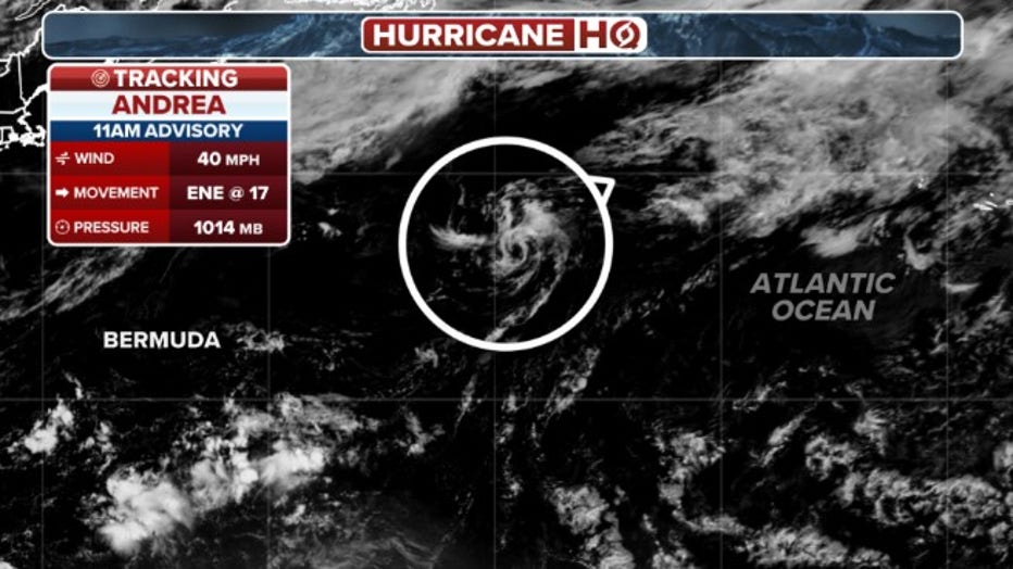
This graphic shows the location and strength of Tropical Storm Andrea.(FOX Weather)
Andrea is expected to weaken beginning Tuesday night before dissipating by Wednesday night, according to the NHC.
Tropical Storm Andrea will not threaten any land areas, remaining over the open central Atlantic Ocean.
WHAT'S THE DIFFERENCE BETWEEN A TROPICAL DEPRESSION, TROPICAL STORM AND HURRICANE?
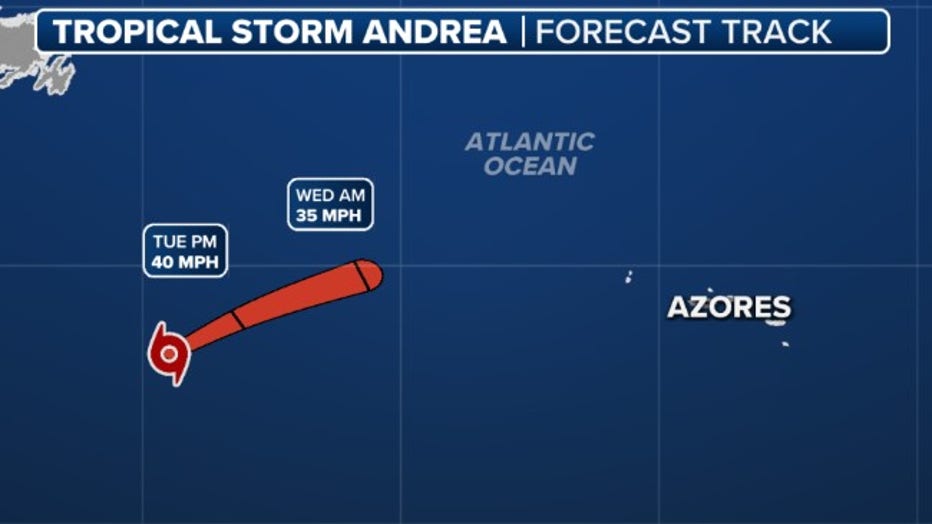
This graphic shows the expected track of Tropical Storm Andrea.(FOX Weather)
While Andrea is not expected to have any impacts to land, it does enter the record books as the farthest north and east a tropical system has formed in the Atlantic during June since 1851.
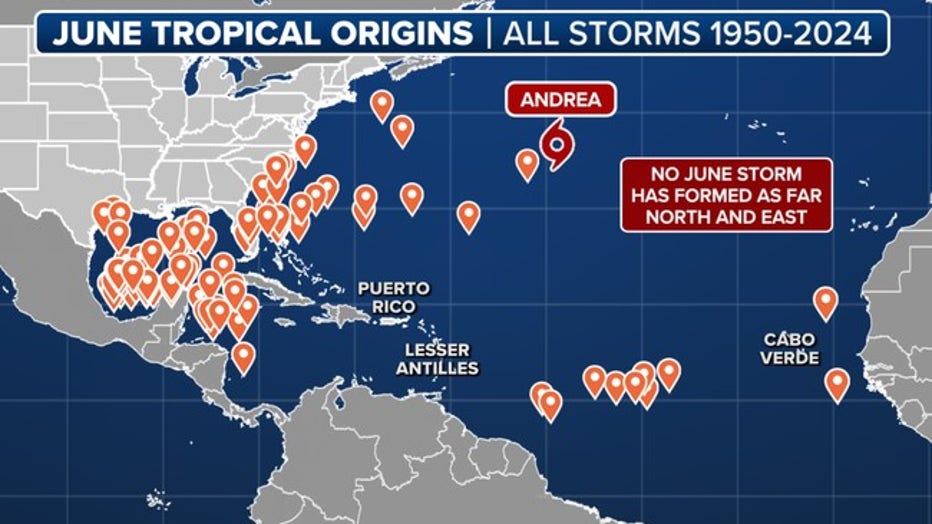
Andrea became the farthest north and east a tropical system has formed in the Atlantic during June since records began in 1851. (Note: Only satellite data, which began in 1950, is shown on this graphic.) (FOX Weather)
The Atlantic hurricane season runs from June 1 to Nov. 30.
Read more at FOXWeather.com.