

South braces for another dangerous tornado outbreak that could be ‘even worse’ than last week’s

LOS ANGELES - Millions of people are bracing for another severe weather outbreak across the southern United States on Thursday. The latest spate of bad weather comes just one week after a significant tornado outbreak in the South ripped through the region, causing numerous violent twisters in multiple states.
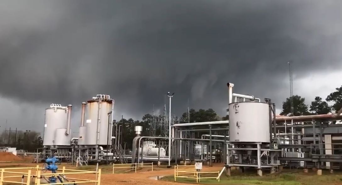
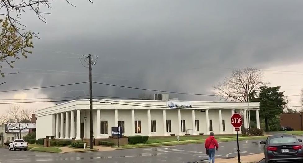
"Thursday's threat could be as severe, or even worse, than last week's tornadoes and severe thunderstorms across the southeast and mid-Atlantic states, when 47 tornadoes occurred over a two-day period," Bill Bunting, the chief of forecast operations at the NWS’s SPC, told FOX Television stations.
Who is at risk
States in the highest risk area include northern Mississippi, Alabama, Tennessee, southern Kentucky, the Missouri Bootheel, eastern portions of Arkansas and northwest Georgia.
However, the outbreak of severe thunderstorms and tornadoes is expected to occur over an even larger swath extending from east Texas north and east through Louisiana, Arkansas, Mississippi, Alabama, Tennessee, Kentucky, western Georgia, the western Florida Panhandle, and southern portions of Missouri, Illinois, Indiana and Ohio.
RELATED: Severe storm threat moves into Southeast US, bringing possible tornadoes, damaging winds
A small part of western North Carolina and Virginia may also be impacted.
Severe weather risks on Thursday
Risks include intense thunderstorms, which are forecast to breakout across the Deep South and track towards the Tennessee Valley Thursday afternoon into the evening hours.
"A myriad of weather hazards; both severe and rainfall, are a recipe for a dangerous weather setup in the Mid-South on Thursday," the National Weather Service’s Storm Prediction Center (SPC) wrote in its forecast discussion.
Other risks that will likely be on display Thursday include strong tornadoes, damaging winds, large hail and flash flooding.
The Storm Prediction Center posted a moderate risk for severe weather over southern Tennessee, northern Mississippi and northern Alabama, while an expansive slight risk area is in place from the central Gulf Coast on north into the Ohio Valley.A slight risk for excessive rainfall is in place from northern Mississippi and Alabama on north into the Tennessee Valley.
RELATED: Multiple twisters touch down in Alabama, Mississippi as wave of tornadoes moves through South
According to the NWS forecast office in Birmingham, Alabama, the storm’s shear will be very supportive of tornadic supercells evolving out of initially disorganized activities.
"Multiple long-track strong tornadoes could occur along and northwest of I-59," NWS Birmingham said. "The worst case scenario includes the potential for a ‘violent’ (EF-4) tornado in the event of the most favorable storm evolution."
Timing of the potential tornado outbreak
The severe threat is expected to develop and peak Thursday afternoon and may linger into Thursday night across the Tennessee and Ohio Valleys while the Northeast contends with periods of rain overnight Thursday.
The threat of severe weather will taper off as the storm system moves east on Friday.
"People in the affected areas need to make sure that they have a severe weather safety plan that includes where to take shelter in the event a severe storm approaches, and have more than one way of receiving severe thunderstorm and tornado warnings," Bunting said.
"A NOAA Weather Radio can be programmed to alert you when warnings are issued for your county or parish, and can wake you up if the storm occurs when you are sleeping," Bunting continued. "It's very important to have thought about safety before the warnings are issued."
A violent start to tornado season
While tornado season typically runs from March through June, it has been off to an active start.
Last week, tornadoes knocked down trees, toppled power lines and damaged homes in several communities. More than 70,000 homes and businesses were without power from Texas to Alabama.
"It is difficult to predict how an entire season will play out just based on early season activity, but we are entering the time of year when severe thunderstorms and tornadoes most often occur," Bunting wrote. "Regardless of whether the season is above or below normal, everyone needs to prepare for the possibility of severe storms now, and make sure you have multiple ways of receiving life-saving severe storm warnings. It only takes one storm to make it a bad year if it affects you!"