

Weather in Tampa: Cold front arrives this week behind line of storms

Tampa weather | rising humidity into storms, front
FOX 13 Meteorologist Jim Weber said it should be warm and humid on Tuesday before a wave of storms brings a cold front on Wednesday.
TAMPA, Fla. - A cold front is approaching Florida.
After a warm, dry, sunny Easter weekend, humidity levels and temperatures are expected to climb in the first half of the week before a line of storms ushers in what will likely be one of the last cold fronts Floridians will see until the fall.
FOX 13 Meteorologist Jim Weber says temperatures will soar into the mid-80s, and possibly the upper 80s away from the coastline on Monday and Tuesday.
He noted that there is enough dry air in place that temperatures will cool quickly during the overnight hours before warming up during the day.
According to Weber, a southerly wind will increase the humidity levels early in the week. But, by the time a cold front moves through on Wednesday, the humidity drops on Thursday and stays low through the weekend.
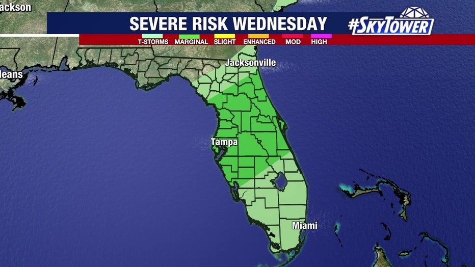
A line of storms is expected to pass through the Bay Area on Wednesday ahead of a cold front.
STAY CONNECTED: Download the free FOX 13 News app for Live SkyTower Radar, forecast videos, and more weather coverage
He adds that there is a 70 percent chance of rain on Wednesday as the cold front works its way into the Bay Area. The storms may stick around into the evening hours but are expected to clear out by Thursday morning.
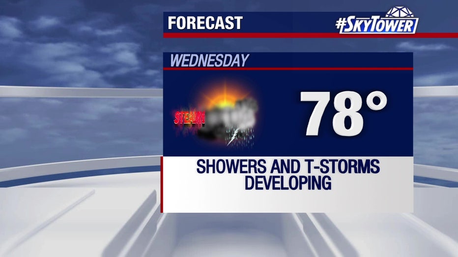
There is a 70 percent chance of rain on Wednesday ahead of a cold front.
The cold front will drop temperatures into the 70s during the day and the mid-50s at night.
Weber says the weekend will be sunny and dry with temperatures in the 70s.
SIGN UP: Click here to sign up for the FOX 13 daily newsletter