

Why are hurricanes getting stronger quicker?

Researchers study rapidly intensifying hurricanes
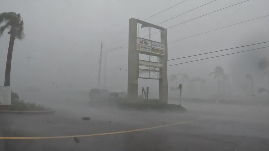
Fresh water from river plumes may explain why hurricanes are getting more intense at a quicker pace. FOX 13’s Briona Arradondo reports.
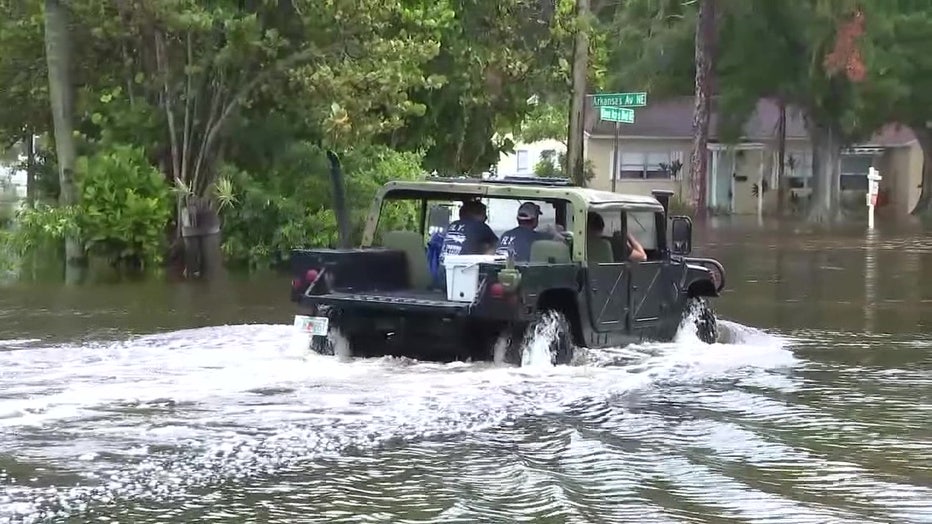
TAMPA, Fla. - Hurricanes have been getting more intense and causing more damage in recent years and that’s why researchers at the University of South Florida are studying why hurricanes can go from Category 1 to Category 4 in one day.
Hurricane season began nearly a month ago, but it usually peaks in the fall.
"Typically, a hurricane would intensify in the Gulf of Mexico in August or September because the water is so warm. It has a lot of heat, energy, right? So that's not surprising. What is surprising is it intensified so fast from Category 1 to Category 4 in just 24 hours. That is surprising," said Chuanmin Hu, an oceanography professor at the University of South Florida.
Dig deeper:
Hu is studying the impacts of Hurricane Idalia in 2023. He said Idalia went over what’s called a river plume, a mix of saltwater and fresh water coming from rain and groundwater in rivers that flow into the Gulf.
"So, the ocean water is already very warm. But now, if you have a very fresh, buoyant, river-prone water on top of that, that will reduce the mixing of the surface warm water and the deep cold water," said Hu.
READ: Residents express concern as Phillippi Creek dredging project reclassified to standard permit
That warm water just sitting led Idalia to go through a process called rapid intensification, making forecasting and tracking very important.
What they're saying:
"We look at things like the loop current, the warm water leaving the Caribbean and finding its way back out into the Atlantic as one of the things that could rapidly intensify a tropical storm into a very powerful hurricane before landfall," said FOX13 Meteorologist Nash Rhodes.
READ: Tampa General Hospital adding AquaFence again this year to prevent storm surge
Rhodes said Florida saw this most recently with Helene and Milton, adding that research on river plumes could be worth looking into and possibly use in modeling.
"We talk about this all the time. These models are as good as the data that we give them," said Rhodes. "If we learn new things, potentially this, that could be something that we could plug into the models and potentially make them more accurate down the line."
Hu said USF’s study isn’t the first to look at the impact of river plumes on hurricanes. But he said it is another piece of evidence to help the modelers we rely on.
"We need to put more effort and more resources to make better predictions so people can better prepare," said Hu. "We all need to thank the modelers, the hurricane trackers. Everybody should thank them. Without them, what do we do once the hurricane comes."
The Source: This story was written with information gathered by FOX 13's Briona Arradondo.