

High-tech hurricane tracking system uses drones above and below water

ST. PETERSBURG, Fla. - Inside a building along St. Pete’s waterfront, scientists are getting a look at data that could save lives during a hurricane.
The director of NOAA, John Cortinas said his organization is partnering with the company Saildrone to launch a mission that will let them see parts of hurricanes not normally visible to humans.
This is the second time NOAA and Saildrone have partnered for a hurricane mission.
Saildrone sends unmanned aircraft and watercraft to get simultaneous views above and below the water.
The drones read storm surge levels, wind speeds, water temperature and currents to help scientists better understand how the Atlantic Ocean or Gulf of Mexico transfers energy to the storm.
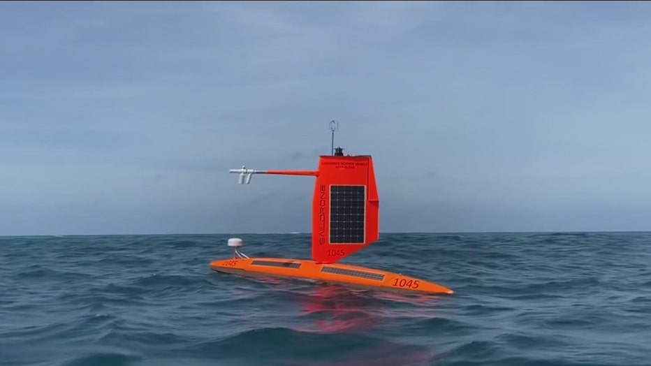
Saildrone has deployed unmanned air and watercraft to monitor hurricanes
"It certainly helps to understand how storms evolve. It’s very difficult, if not impossible to collect data at that interface, and it’s very important because that’s where the transfer of energy helps occur to help fuel these storms," Cortinas said.
Ten years ago, a tropical system would have to be in line with a sensor in the ocean to get similar readings. Now, drones can maneuver into the eye of a storm remotely.
Last year during Hurricane Sam, a Category 4 storm, a drone was able to fly into the eye of the system and provided first-of-its-kind footage and data.
The drone survived the storm, undamaged, with wind speeds up to 140 miles per hour.
Seven Saildrone machines will leave downtown St. Pete and join an array of underwater gliders and surface drifters, giving the most advanced information about future storms.