

Stormy conditions continue across Florida: what to expect in the Tampa Bay Area

Tampa weather | Stormy conditions across Florida
FOX 13 Meteorologist shares the latest on the stormy conditions moving into the Tampa Bay Area late Sunday into Monday.
TAMPA - After four tornadoes were reported in the Florida panhandle on Saturday, that low pressure system is bringing a significant amount of rain to the Tampa Bay Area starting on Sunday and continuing into the early part of the week.
This system comes as much of the region continues to deal with drought conditions.
FOX 13 Meteorologist Valerie Mills says that the round of storms will feature 1–3 inches and isolated spots could see more rain with gusty winds and possible hail.
The heavy rain could create isolated flooding in certain spots.
Timeline:
The atmospheric river that is moving across the southeast will continue to build from Sunday into Monday.
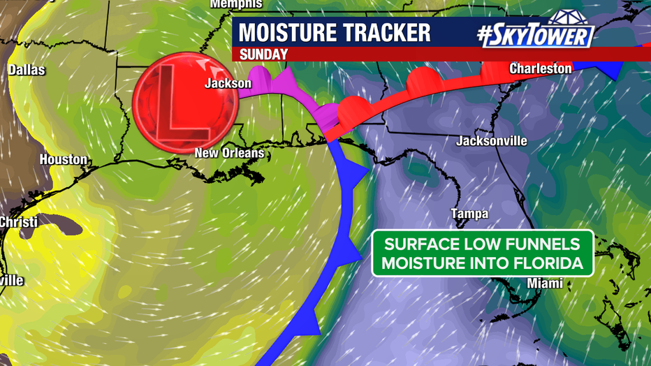
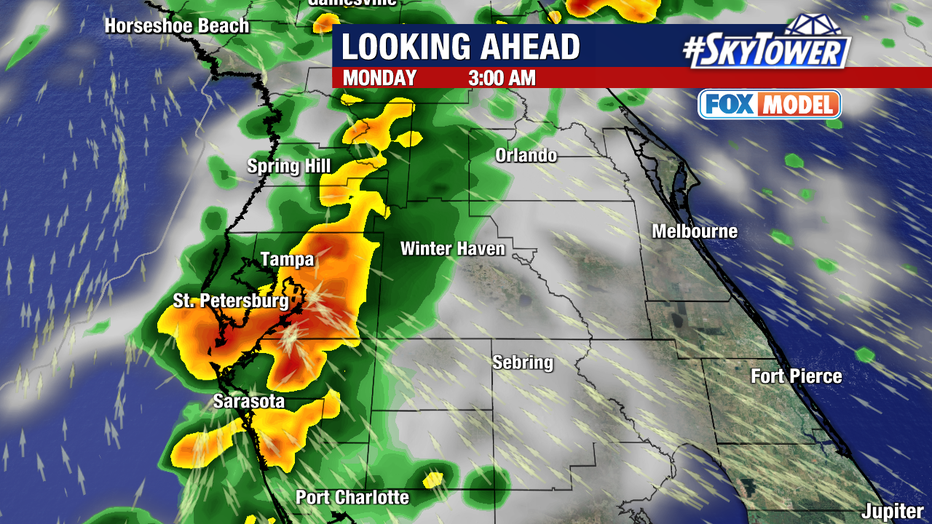
Tracking the rain impact from Sunday into Monday.
"We are really going to ramp up our storm coverage," Mills says. "We are talking about 60% coverage today (Sunday), that stays elevated tonight. And then tomorrow (Monday) we are up to 80% coverage."
Tracking possible storms across the Tampa Bay Area.
Central Florida will see higher rain totals and FOX 13 Meteorologist Nash Rhodes says the morning will bring the bulk of the weather impact with less coverage in the evening.
Highlands County Emergency Management shared this picture on Facebook of a steeple that toppled over in Highlands County.
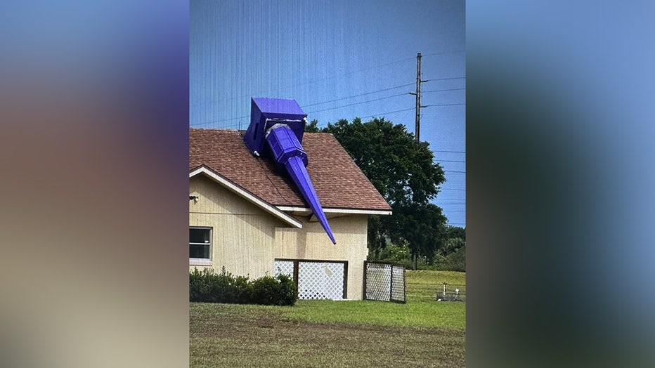
Courtesy: Highlands County Emergency Management.
Rhodes says that wind speeds in that area reached at least 47 MPH on Sunday.
What's next:
Looking past Monday, Rhodes says that Tuesday has a 20% chance of rain and Wednesday has 10% before the rest of the week drops to near zero.
CLICK HERE:>>> Follow FOX 13 on YouTube
The Source: Information for this story was gathered by FOX 13 Meteorologists.
STAY CONNECTED WITH FOX 13 TAMPA:
- Download the FOX Local app for your smart TV
- Download FOX Local mobile app: Apple | Android
- Download the FOX 13 News app for breaking news alerts, latest headlines
- Download the SkyTower Radar app
- Sign up for FOX 13’s daily newsletter