Tropical Storm Sara forecast to dissipate before reaching Gulf of Mexico, remnants will bring rain to Florida

Tropical Storm Sara expected to dissipate
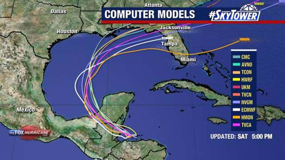
Tropical Storm Sara is expected to dissipate before reaching Gulf of Mexico. FOX 13 Meteorologist Valerie Mills says Florida will get a taste of the tropical moisture from the remnants of Sara next week.
TAMPA, Fla. - Florida is expected to face a widespread rainfall event mid-workweek when moisture from the remnants of Tropical Storm Sara interacts with a frontal system.
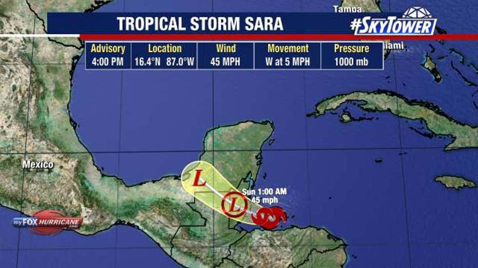
As of 4 p.m. Saturday, Sara was located at 16.4N and 87.0W. It had maximum sustained winds of 45 miles per hour and was moving west at 5 miles per hour.

The storm was in the Gulf of Honduras and headed towards Belize on Saturday. Life-threatening and catastrophic flooding and mudslides are ongoing for portions of Central America, according to the National Hurricane Center.
The NHC says Sara is expected to dissipate Sunday night or Monday as it crosses the southern portion of the Yucatan Peninsula.
What can Florida expect?
"The tropical moisture associated with Sara is going to get lifted into the Gulf of Mexico, merges with this cold front that's going to be moving across the country, and so we're actually going to get a taste of some of this tropical moisture moving ahead next Tuesday into Wednesday," explained FOX 13 Meteorologist Valerie Mills.

There will be a round of rain brought back to Florida around Wednesday. Mills says the stronger front will also bring cooler air to the Sunshine State.
"Other than Sara, there's no other areas of interest that we're tracking at this time as we are exactly two weeks away from closing out this hurricane season," shared Mills.
STAY CONNECTED WITH FOX 13 TAMPA:
- Download the FOX Local app for your smart TV
- Download the FOX 13 News app for breaking news alerts, latest headlines
- Download the SkyTower Radar app
- Sign up for FOX 13’s daily newsletter

