

Cold front brings possibility for severe storms across Tampa Bay Saturday
TAMPA, Fla. - After a line of storms moved across Florida Thursday, Friday's weather will stay relatively calm, with a few sprinkles moving down to Central Florida from the northeast.
Saturday, however, brings another front that will likely cause strong to severe storms across the Bay Area, and significantly drop temperatures.
The rain Friday will stay mostly north of the Bay Area, hovering near the Panhandle. Showers could creep south of there, to parts of Citrus, Hernando and Pasco counties.
FOX 13 Meteorologist Dave Osterberg says the front will start pushing its way southeast early Saturday morning.
Temperatures Friday will stay warm, with highs in the mid-80s. Winds will begin to increase Friday into Saturday, with gusts expected around 20 miles per hour Friday.
MORE: Daylight saving time 2022: How to prepare your body for the time change

By Saturday morning, some areas could see gusts up to 40 miles per hour.
The chance for severe weather starts after sunrise, with current models showing a line of strong to severe storms moving across Tampa Bay between 9 and 10 a.m.

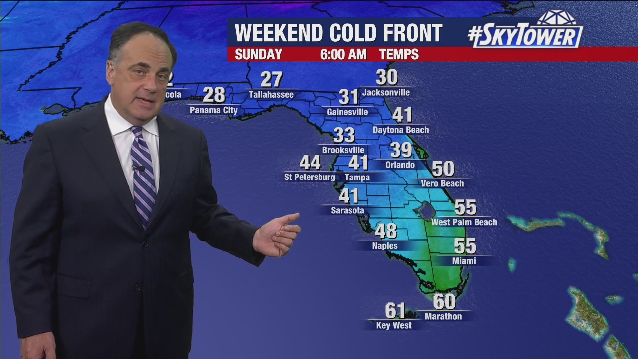
After the storms move through, temperatures begin to drop.
After an expected high of 85 Friday, Sunday morning will bring one less hour of sleep and temperatures in the low 40s.
Download the SkyTower Radar app on Android and iPhone to get weather alerts and live radar views wherever you are.
