

Tropical wave could move to Gulf of Mexico next week, expected to be ‘Hermine’ soon

Today's tropical weather forecast
Meteorologist Jim Weber shows the next area of interest in the Atlantic that, with the right conditions over the next week, could end up as a storm in the Gulf of Mexico. Meanwhile, Hurricane Fiona and Tropical Storm Gaston continue to swirl far off the US East Coast.
TAMPA, Fla. - While Fiona and Gaston avoid the U.S., a tropical wave entering the Caribbean is one that states along the Gulf of Mexico should keep an eye on.
Invest 98L is east of Trinidad and Tobago and will likely become a tropical depression in the next couple of days, according to the National Hurricane Center. It's also favorable to become Tropical Storm Hermine soon after that.
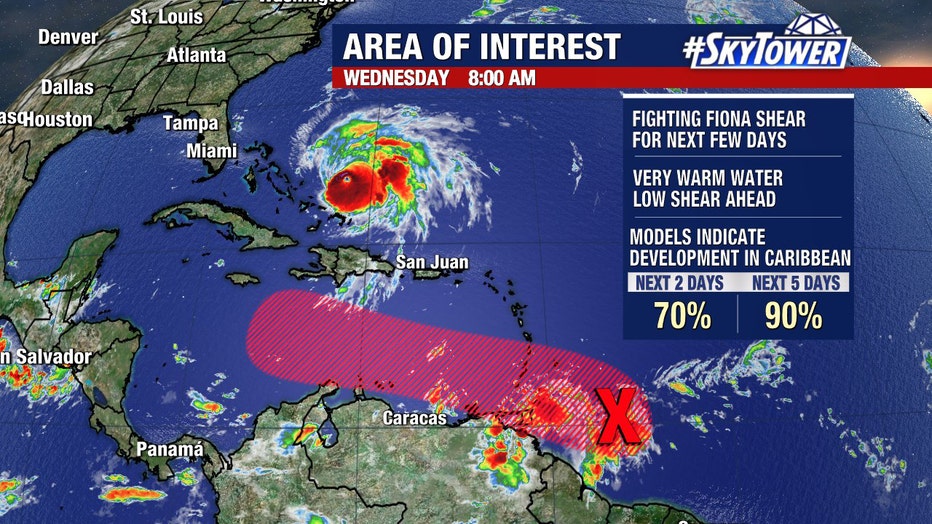
Invest 98L on the morning of Sept. 21.
At the moment, computer models show the disturbance will continue moving west into the Caribbean Sea.
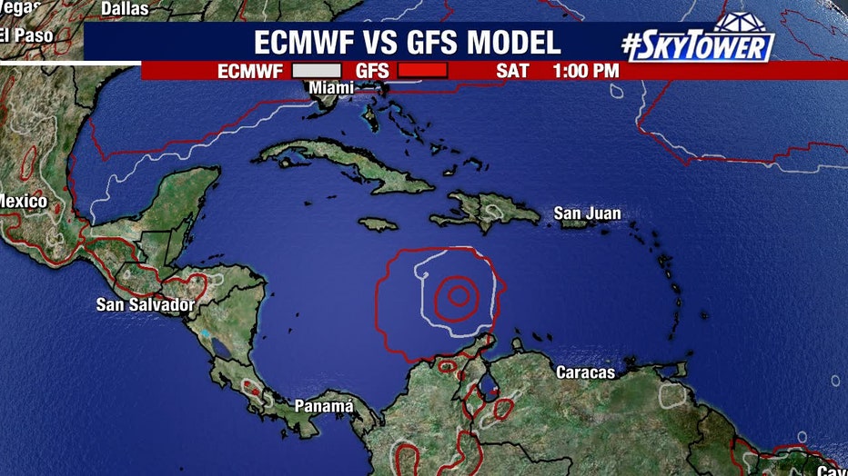
European and GFS models agree that Invest 98L will be in the area by Saturday, Sept. 24
"In the short term, all of the models are in agreement. Here’s Saturday, you’ve got the European right on top of the GFS, then working its way up through the Caribbean," explained FOX 13's meteorologist Dave Osterberg. "My biggest fear is once the storm gets here into the Western Caribbean, this place has been untouched by storms all season long. There’s an incredible heat in the Caribbean here and that could rocket fuel to a system like this."
LINK: Track the tropics on MyFOXHurricane.com
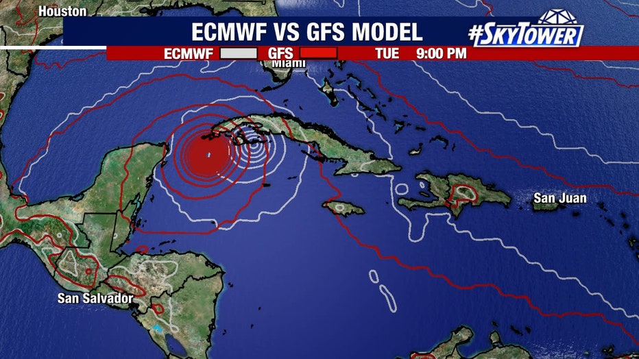
This graphic shows where the European and GFS models believe, as of Sept. 21, 2022, where Invest 98L will be located by Tuesday, Sept. 27.
After that, there are some models showing it enter the Gulf of Mexico, but the long-term range is still up in the air.
MORE: New to Florida? Here’s a guide to help prepare for your first hurricane season
"There’s nobody out there who can tell you exactly where this is going to go next week. It could get into the Gulf. It may get into the Gulf," Osterberg said. "From Texas to Florida, we all have to keep an eye out."