

Hurricane Erin prompts warnings along parts of U.S. coast as NHC watches 2 tropical waves

Hurricane Erin moving north; tracking Invest 99L
FOX 13 meteorologist Jim Weber has the very latest on Hurricane Erin and is tracking other waves in the Atlantic.
TAMPA, Fla. - Hurricane Erin is bringing strong waves and life-threatening rip currents to the Atlantic coast, including Florida, leading to warnings in some areas as the storm moves east of the U.S. over the Atlantic.
Hurricane Erin's track
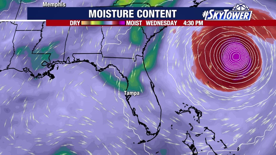
As of 5 p.m. Wednesday, Erin was located at 31.2N and 73.6W with maximum sustained winds of 110 mph.
The Category 2 hurricane is moving north at 13 mph.

According to the National Hurricane Center, a tropical storm warning is in effect along the coast from North Carolina to New Jersey.
Evacuation orders are in effect for parts of the North Carolina Outer Banks, where tropical storm conditions are expected late Wednesday.

Tropical storm conditions are possible in Bermuda on Thursday and Friday, as well.
As for Erin's strength, FOX 13 Meteorologist Dave Osterberg says there's a chance the hurricane could slightly restrengthen after wind shear limited intensification on Tuesday.
More tropical waves in Atlantic
The NHC continues to watch a pair of waves in the Atlantic, including one over the central Atlantic that has a 60% chance of development in the next seven days. Osterberg says it could follow Erin's path, regardless of development.
Another wave southwest of the Cabo Verde Islands, dubbed Invest 99L, has a 40% chance of development in the next seven days, according to the NHC.

Tampa Bay area forecast
Osterberg says Erin is pulling moisture away from the Tampa Bay area, dropping rain coverage to just 20% on Wednesday and 30% on Thursday.
The Source: This story was written with information from FOX 13 meteorologists and the National Hurricane Center.