

Tropical Depression Two forms: What it means for your week
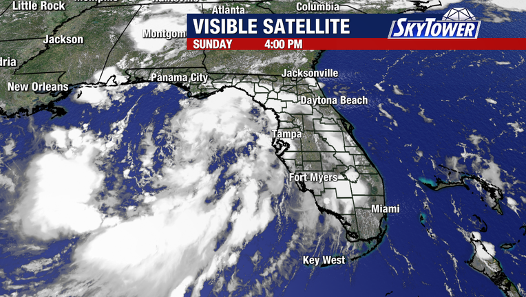
TAMPA, Fla. - Tropical Depression Two formed off Florida’s west coast Sunday morning and is expected to become Tropical Storm Bertha within the next day or two as it continues to organize.
A Tropical Storm Watch is now in effect for much of the Florida Panhandle coastline, from the Ochlockonee River west to the Alabama border, where tropical storm conditions are possible within the next 36 to 48 hours.
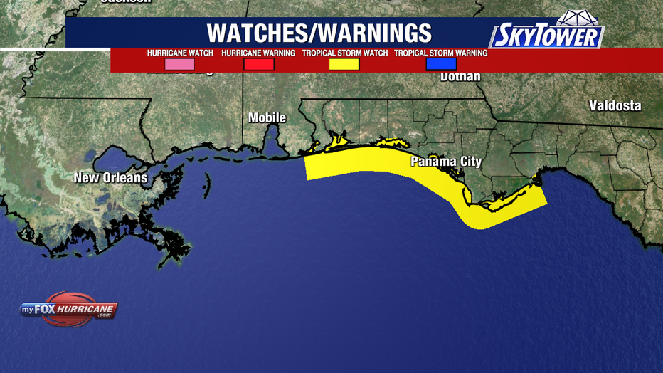
Additional watches or warnings could be issued farther west over the next couple of days.
Local impacts
What we know:
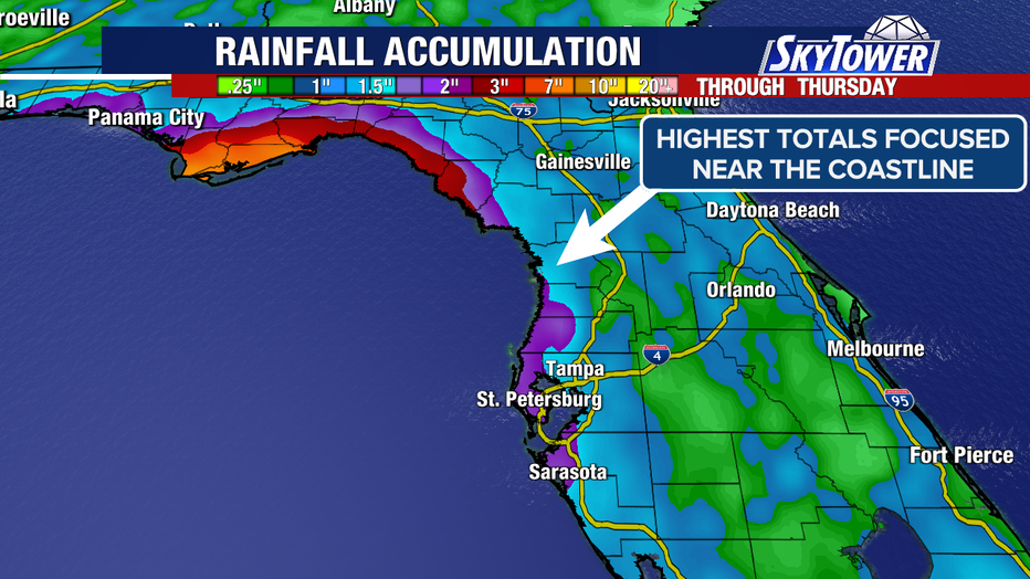
For the Tampa Bay area, very little has changed. Forecasters say the system will continue moving away from our coastline, so we’re not expecting significant local impacts.
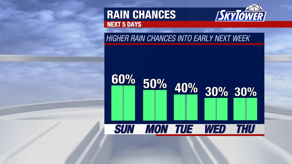
The main concern remains periods of showers and thunderstorms, with higher rain chances continuing into early next week before coverage gradually decreases as the system pulls farther away.
Additional Hurricane Hunter reconnaissance flights this afternoon should provide a clearer picture of the storm’s structure.
Future forecast
Timeline:
After the 48-hour mark, the forecast becomes more uncertain.
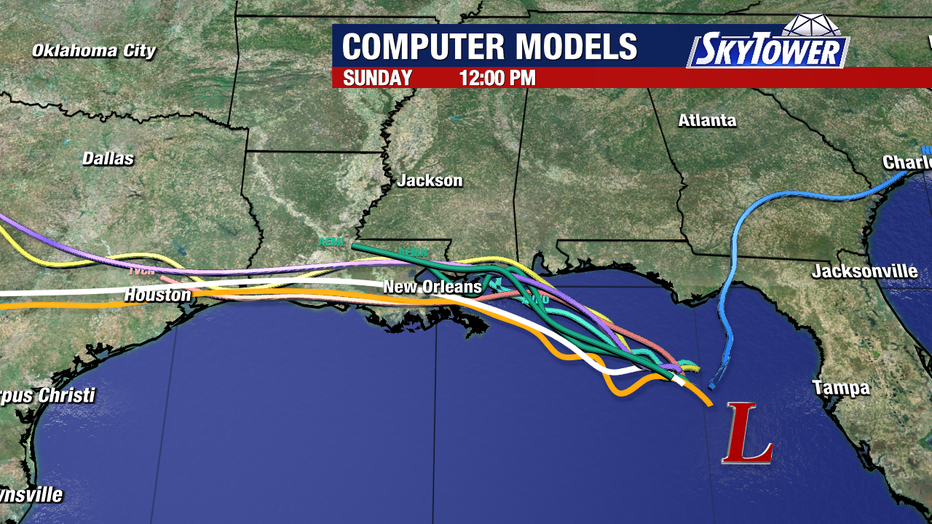
Forecasters say if the center stays close to the northern Gulf Coast, land interaction and pockets of drier air wrapping into the circulation would likely limit strengthening, favoring a weaker system tracking toward eastern Louisiana.
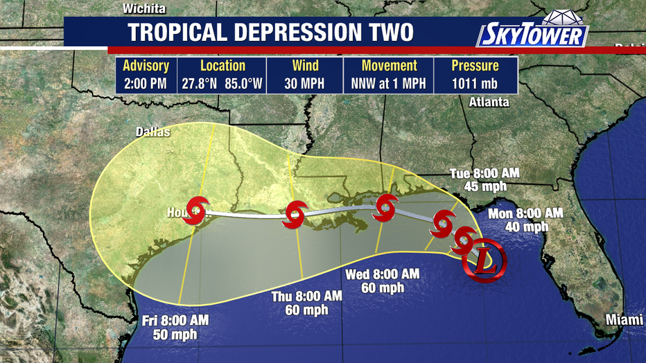
However, if the center remains farther offshore over the open, very warm Gulf waters, it will have a better opportunity to organize and strengthen, potentially reaching hurricane strength.
Exactly how close the center stays to the coastline over the next couple of days will play a major role in determining both its strength and eventual track.
Impact of Tampa Bay
Dig deeper:
Meteorologists say Tampa Bay’s forecast has changed very little.
The greatest uncertainty lies in how strong the system becomes after it moves away from Florida, and that will largely depend on the balance between warm Gulf waters versus limiting factors like dry air and land interaction.
The Source: Information in this story was gathered by FOX 13 Meteorologist Nash Rhodes, the National Hurricane Center for tropical weather outlooks and forecast computer models.