Forecast: First day of winter brings stormy conditions to Bay Area before cooler air settles in

TAMPA, Fla. - Florida has been facing higher than normal temperatures, but on this first day of winter, there will be some changes to the rest of the week.
Before Tuesday's sunrise, heavy rain and storms were sitting offshore. They began moving into the Bay Area during the morning hours. Wind will pick up in the afternoon, explained FOX 13’s meteorologist Dave Osterberg.
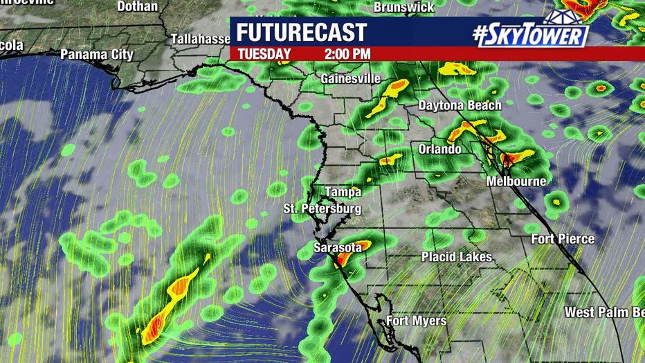
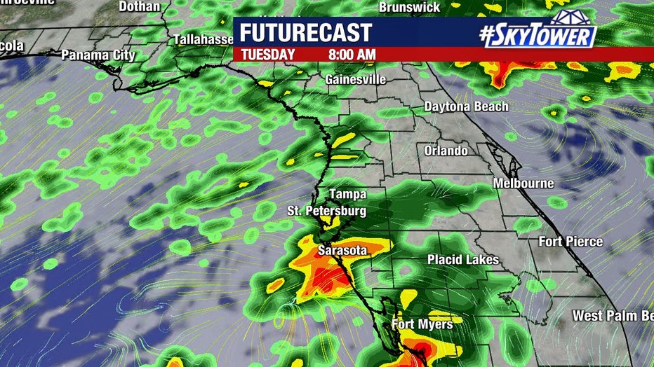
"I got to tell you that even though it’s a marginal to slight risk for strong to severe storms today, we are going to get a good healthy amount of rain, and that’s nice," he said. "We really could definitely use the rainfall. As we get into the afternoon hours, things will gradually improve."
LINK: Check the forecast on FOX13News.com
That low pressure will eventually move across the state throughout Tuesday.
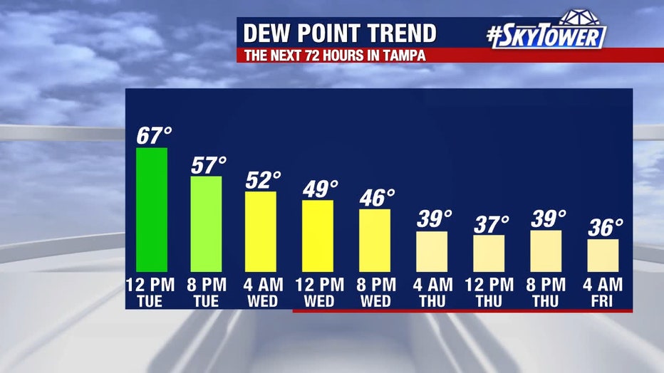
"Once it gets to the east of us, our winds are going to shift to the northwest and here it comes. After all that record-breaking warmth in the month of December, we are finally going to have some cooler air settle in," Osterberg offered. "Think of this as our transition day."
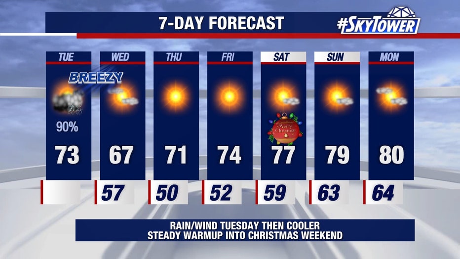
After today, you can expect "beautiful weather." By Wednesday, the low temperature during the morning hours will be in the 50s, with a high in the low 70s.
"For the first time in a long time, we are dropping it down to the 50s. Look at the rest of the week. Does that not look amazing -- including Christmas Day?" Osterberg said while referencing the 7-day forecast. "It’s a little bit above normal but not too bad with highs in the upper 70s."