

It's August and the tropics are quiet, but it’s not as weird as it feels

Today's tropical weather forecast
Meteorologist Jim Weber gives us our first look at the first day of August in the 2022 Atlantic Hurricane Season, when anywhere in the Atlantic "is fair game" for potential tropical activity.
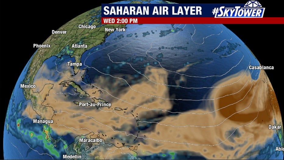
TAMPA, Fla. - August dawned on a very dry tropical atmosphere over the Atlantic. The satellite image below shows the water vapor in the mid-levels of the atmosphere. The brownish-orange colors are representative of the dry air.
Much of the dryness is caused by Saharan dust that has spread east to west across the ocean. On average, the dustiness is waning by the time August rolls around, but in recent years it has continued to be something of a factor later in the month – perhaps because the Sahara Desert is expanding in a warmer world.
Memory is a funny thing. While it seems like the tropics have been eerily quiet, just last year, there was no activity between July 9, when Tropical Storm Elsa dissipated, and August 10, when Tropical Storm Fred formed just south of Puerto Rico. July pauses are not an unusual occurrence. Although this one will be stretching it a bit if nothing develops in the next couple of weeks.
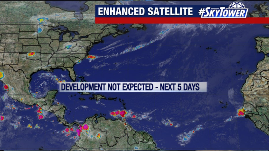
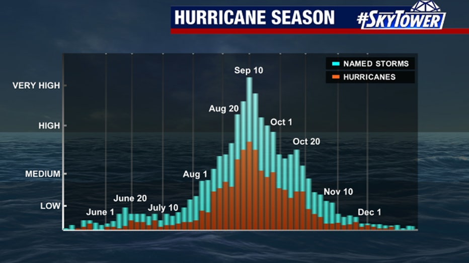
On average, the third tropical storm is not named until Aug. 3, so we’re still slightly ahead of the game for the moment. No development is expected this week, however, so we’ll likely fall below the average curve for a while.
PREVIOUS: Two 'B' named storms in the Eastern Pacific this year -- but how?
It seems like hurricane seasons have been consistently long and annoying in recent memory, but the heart of the season, when almost all the strong and destructive storms have formed, runs from about Aug. 20 to Oct. 20. Dr. Bill Gray, the originator of seasonal hurricane forecasts in 1984, used to ring a bell on Aug. 20, which meant, "Here we go!"
The earliest Cat3+ Miami-area hurricane was Hurricane Andrew on Aug. 24, 1992. Hurricane Charley, which hit just north of Fort Myers, Florida on Aug. 13 in the busy hurricane year of 2004, was one of the unusual exceptions.
So, even though the long-range computer forecast models remain storm-free in the Atlantic, that doesn’t say anything about what will happen when, on average, conditions fall into place that are conducive to hurricane development in a few weeks. The macro weather pattern still appears supportive of a reasonably busy hurricane season.
The only patch of reliably conducive atmosphere so far this season has been over the eastern Pacific Ocean off the coast of Mexico. We’ve seen six hurricanes and a tropical storm, which is far above normal activity for this point in the season, and unusual in a La Niña year when the water in the equatorial tropical Pacific is cooler than normal.
This year, however, there is a substantial patch of warm water off of Mexico just north of the cold tongue that we look at to define La Niña. In addition, the overall atmospheric pattern has been stuck in a mode that is conducive to storm development in that area.
An interesting question is to what degree that stuck pattern is related to the persistent and extreme heat that has lodged over the middle and western part of the U.S. There are indications that extreme weather, which is related to deep waves in the polar jet stream, is more likely to linger in a warmer world. Thus, more long stretches of extreme heat, persistent rain, etc.
The Arctic is warming much faster than the tropics as we heat the atmosphere – a phenomenon that is well understood. The reduced temperature contrast from north to south around the planet is likely responsible for the extra waviness and possibly the non-progressive nature of the jet stream. It’s an area of very active study.
In any case, it will be two or three weeks before we can say that something unusual is happening in the Atlantic. For now, it’s status quo… and quiet.
Get updates on this story from FOX Weather