

Higher rain chances for Bay Area on Thursday, more heavy rain possible for July 4th

Tampa weather | Higher rain chances Thursday
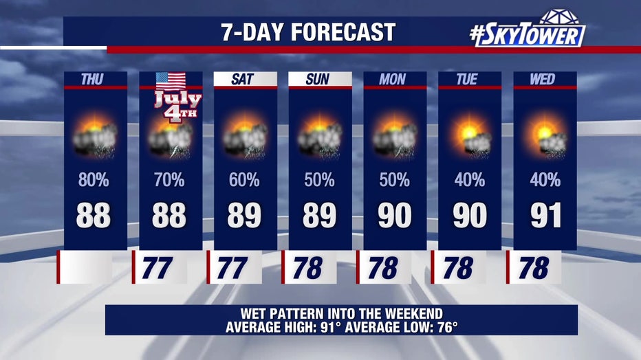
FOX 13 Meteorologist Dave Osterberg says rain chances will go up to 80 percent on Thursday with showers and storms developing throughout the day. It won’t be a total washout, however, and the afternoon high should stay below 90 degrees.
TAMPA, Fla. - Showers and storms will continue moving through the Tampa Bay area in the days to come as a stalled front to our north leads to more unsettled weather.
Thursday forecast
FOX 13 Meteorologist Dave Osterberg says heavier showers began moving in early Thursday, and more will approach the coast throughout the day.
It won't be a washout, according to Osterberg, but rain chances are high at 80 percent.
Will there be development in the tropics?
As of Thursday morning, the National Hurricane Center is giving an area of low pressure a 60 percent chance of development in the next seven days. If there is any development, it would be in the western Atlantic and not the Gulf.
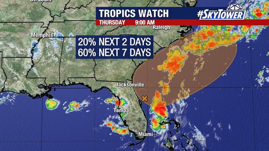
The National Hurricane Center is giving an area of low pressure a 60 percent chance of development in the next seven days.
"At this point, what we're getting is just rain from that stalled out front to our north and the southwest wind – not tropical-related," Osterberg said.
What to expect July 4th
As for the Fourth of July, it should be a similar setup to Thursday. Osterberg says scattered showers and storms will continue with rain chances at about 70 percent.
And when it comes to outdoor plans?
"The Fourth of July is not going to be a washout," Osterberg said.
We'll see a gradual drop in rain chances through the weekend, with coverage down to 60 percent by Saturday and 50 percent on Sunday. High temperatures could get back to 90 degrees in Tampa next week.
Rain chances remain high over the next few days before dropping next week, meteorologists say.
The Source: This story was written with information from FOX 13 meteorologists.