

Hurricane Lee jumps to Category 5 strength, reaching 'major hurricane' status

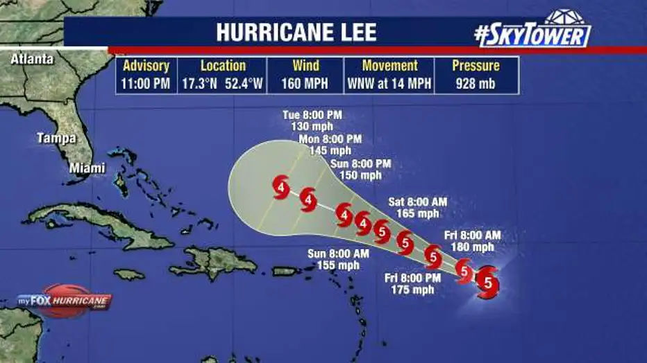
TAMPA, Fla. - Hurricane Lee, which formed in the Atlantic on Wednesday, strengthened into a Category 5 storm on Thursday eveing.
As of 11 p.m. on Thursday, Hurricane Lee was located at 17.3 degrees longitude and 52.4 degrees latitude. It had winds speeds of 160 miles an hour and was traveling west-northwest at 14 miles an hour.
According to the National Hurricane Center, Lee began ramping up and started to show signs that it is wanting to rapidly intensify. The storm strengthened into a Category 2 hurricane as of 11 a.m. Thursday before jumping to a Category 4 storm in the afternoon.
Dangerous beach conditions are expected to develop around the western Atlantic through early next week, according to the National Hurricane Center.
FOX 13 Meteorologist Dave Osterberg says Hurricane Lee was showing an eye early Thursday morning around some deep convections. He says computer models show that warm waters combined with wind shear had Lee on track to becoming a massive hurricane.
READ: Medical experts watching for potential cases of flesh-eating bacteria in wake of Hurricane Idalia
Osterberg says around 10 p.m. on Monday, Hurricane Lee should make a turn to the north. He says at that point it may become an annular hurricane, which means it has a huge eye, deep convection and lacks typical rainbands.
According to Osterberg, Hurricane Lee could possibly become a Category 5 hurricane.
READ: Flamingo on road to recovery after being found off St. Pete Beach after Hurricane Idalia
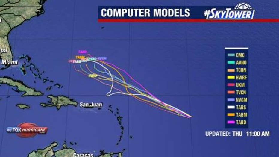
Computer models show Hurricane Lee strengthening and then taking a northern turn.
Osterberg says the closer Hurricane Lee gets to the United States before making that northward turn, the more likely it may impact New England. He says over the next 48–72 hours, Hurricane Lee will continue to move west-northwest.