Tropical Storm Sara stalls over Honduras, could dissipate before reaching Gulf of Mexico
TAMPA, Fla. - Tropical Storm Sara has stalled over Honduras, bringing catastrophic conditions to parts of Central America, but it might not survive its trek over the Yucatán Peninsula, according to the National Hurricane Center.
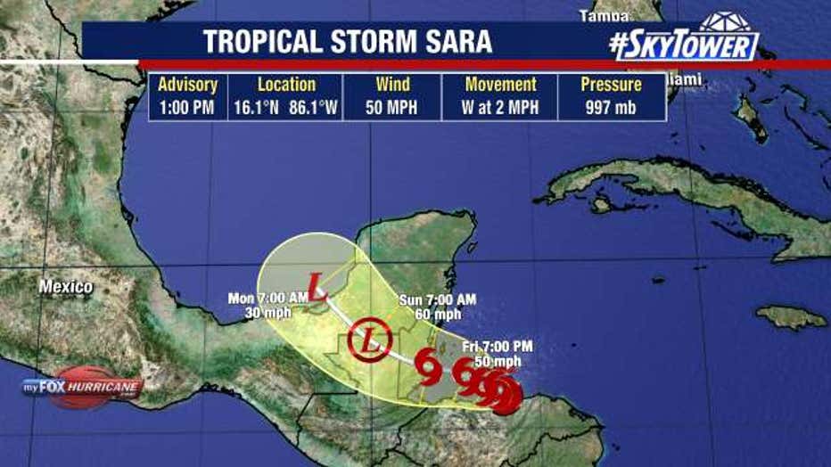
As of 1 p.m. Friday, Sara was located at 16.1N and 86.1W. It had maximum sustained winds of 50 miles per hour and was moving west at 2 miles per hour.
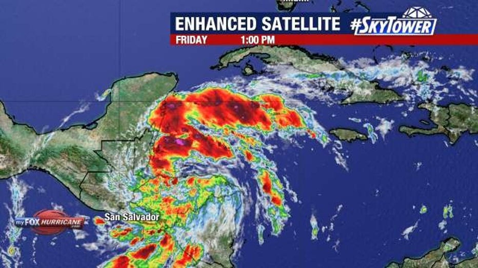
According to the NHC, the storm became better organized on Friday, but interaction with land will limit further intensification.

The National Hurricane Center says Tropical Storm Sara could dissipate before reaching the Gulf of Mexico.
What's next for Sara?
The NHC says Sara will linger over the northern coast of Honduras into Saturday, possibly dumping feet of rain in the region while also bringing life-threatening mudslides. Belize, El Salvador, eastern Guatemala and western Nicaragua will also get heavy rain.

Tropical Storm Sara is bringing catastrophic conditions to Honduras and other areas of Central America.
This weekend, a mid-level ridge moving toward Florida will allow for the storm to turn northwest toward Belize, then move over Mexico.
Models show the system moving through the Yucatán Peninsula, where it could dissipate by Monday before reaching the Gulf of Mexico.
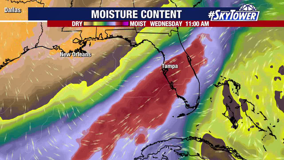
"However, there will be a little bit of moisture that gets pulled into the Gulf," FOX 13 Meteorologist Dave Osterberg said.
What can Florida expect?
Osterberg says the remaining moisture will combine with a cold front, bringing rain to Florida during the mid-to-late portion of next week.

Tropical moisture should bring rain to Florida by the middle of next week, forecasters say.
"But it's not going to be the big ‘bowling ball’ low that you're seeing now," Osterberg said.
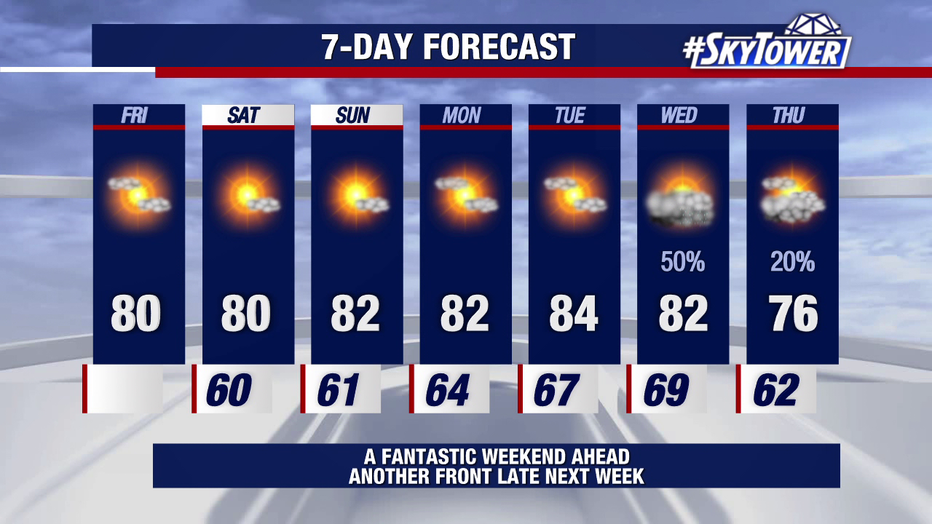
As of Friday, the forecast calls for drier air and lower temperatures to move in behind the moisture, with highs in the 70s by next Thursday.

The forecast calls for cooler and drier air behind next week's rain, with highs in the 70s by next Thursday.
STAY CONNECTED WITH FOX 13 TAMPA BAY:
- Download the FOX Local app for your smart TV
- Download the FOX 13 News app for breaking news alerts, latest headlines
- Download the SkyTower Radar app
- Sign up for FOX 13’s daily newsletter

