

Forecast: Strong storms, then windy and cold

TAMPA, Fla. - Strong storms will soak Central Florida on Tuesday evening as a cold front pushes east, leaving much cooler air behind it.
The front is the same system that’s already brought snow to the Midwest and tornados to parts of the southern U.S. Forecasters say it won’t have quite as much strength here in Florida, but there is still a threat of heavy rain, strong winds, and even an isolated tornado.
“Your risk is higher the further north you go,” FOX 13 meteorologist Jim Weber advised.
After the storms clear out, temperatures will start to drop. The high temperature on Wednesday will only be in the low 60s across the Tampa Bay area.
“Temperatures are going to hold steady or even fall as the day goes on, as the northerly wind is pushing in that cooler and that drier air,” Weber continued. “It’s going to be a windy day tomorrow.”
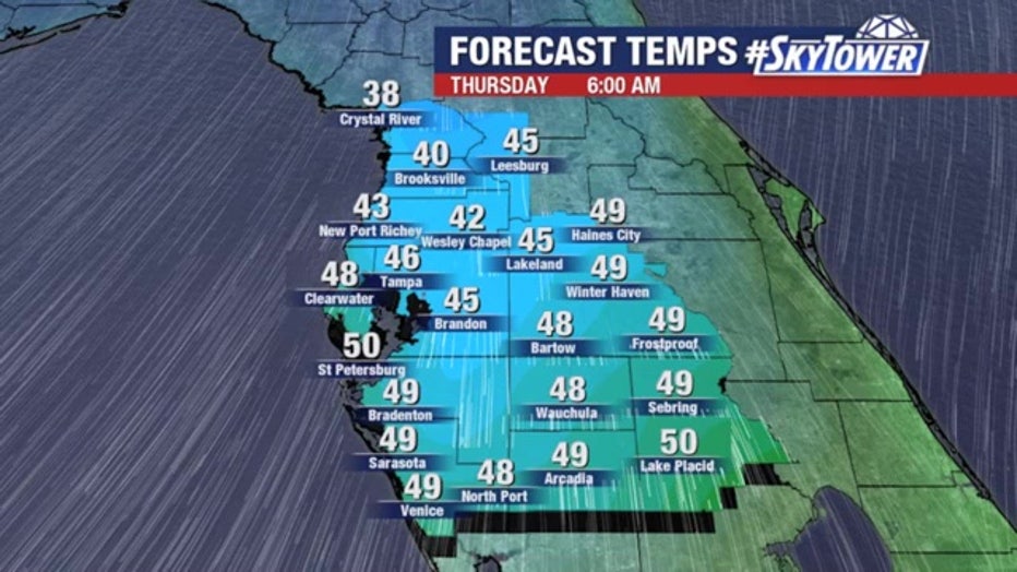
Lows on Wednesday night and into Thursday morning will dip into the mid-40s. Crystal River and areas to the north could be in the 30s.
A warm-up will begin on Friday and highs should remain in the 70s for the next few days, though another round of rain is expected over the weekend.
LINK: Download the SkyTower Radar app for storm and lightning alerts on your phone