

Hurricane Isaias forms in Gulf, expected to strengthen to Category 3
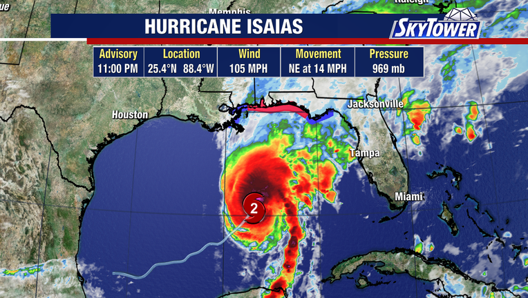
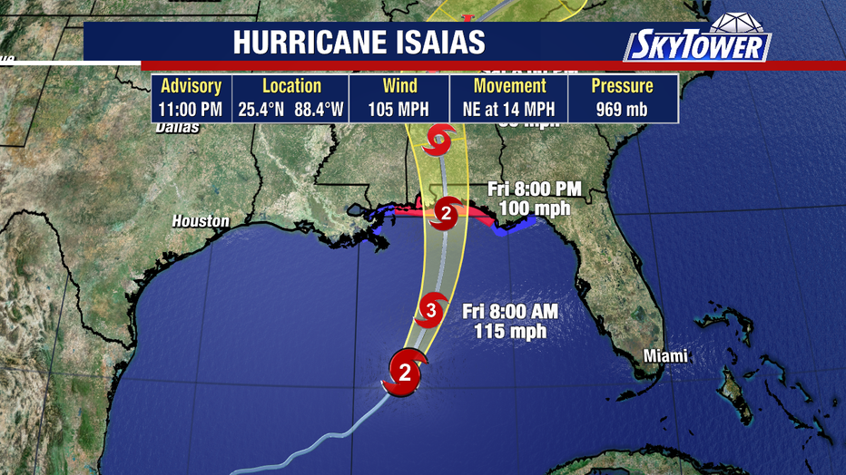
TAMPA, Fla. - Hurricane Isaias is moving across the Gulf and is forecast to strengthen before making landfall along the northern U.S. Gulf Coast late Friday or early Saturday.
Gulf Coast hurricane forecast
What we know:
Hurricane Isaias formed Wednesday in the Gulf. As of Thursday evening, the storm was located about 215 miles north-northeast of Progreso, Mexico, and roughly 290 miles south of the mouth of the Mississippi River.
Additional strengthening is expected through early Friday as the system moves across the central Gulf toward the northern U.S. Gulf Coast.
Storm surge and wind threats
By the numbers:
The system is forecast to bring 3 to 7 inches of rain across the central Gulf Coast, with localized totals up to 10 inches from southeastern Louisiana to the Florida Panhandle. Surrounding areas across the Southeast and Tennessee Valley could see 1 to 3 inches of rain.
As it moves closer toward the Northern Gulf Coast, it will start to be torn apart by very strong wind shear. That said, it will still be very strong as it reaches the coast.
Coastal warnings and watches
What's next:
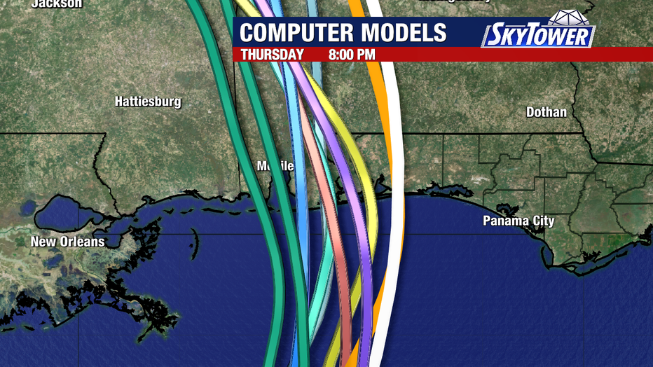
A turn toward the north-northeast occurred on Thursday, with that motion expected to continue through Friday. The storm is forecast to approach the northern Gulf Coast late Friday night into early Saturday.
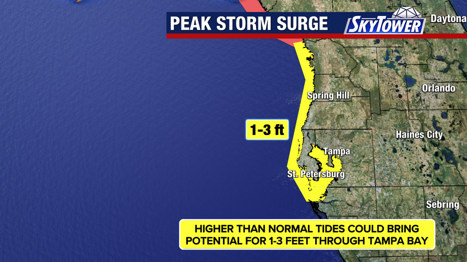
The Tampa Bay area will experience elevated water levels, with tides reaching 1 to 3 feet above normal high tide.
As Isaias approaches the coast, increasing wind shear and dry air will begin to alter its structure, which can trigger severe weather. Outer feeder bands will bring heavy rain and the potential for isolated tornadoes across northern Florida, Georgia, and Alabama.
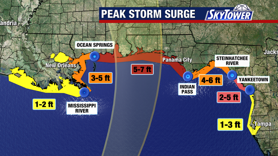
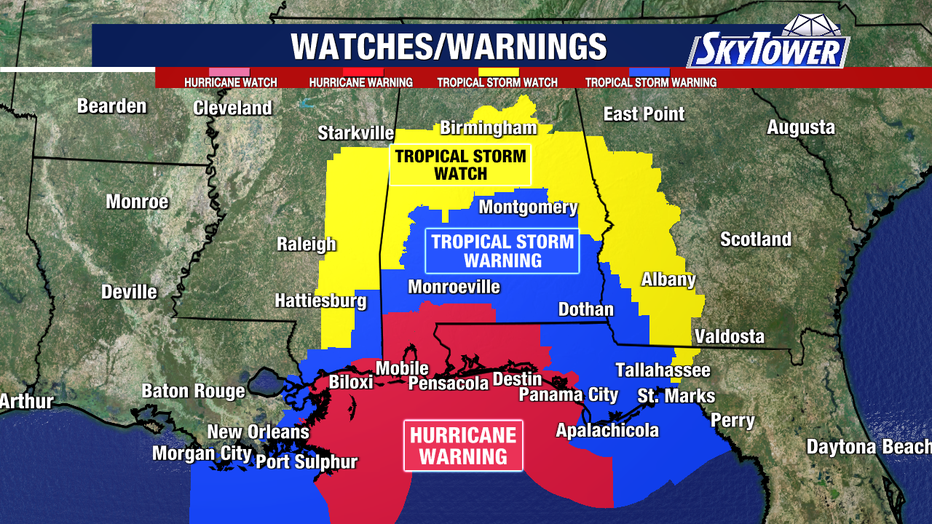
A hurricane warning is active from Ocean Springs, Mississippi, to the Bay/Gulf County Line, Florida. A storm surge warning covers the area from the mouth of the Mississippi River to the Steinhatchee River, Florida.
Unconfirmed storm impacts
What we don't know:
Officials have not yet confirmed the exact peak surge water heights for specific coastal communities along the landfall path.
The precise timing and location of potential flash flooding or river flooding will depend on localized rainfall totals over the weekend.
The Source: The information in this story was gathered from official public advisories and forecast updates issued by the National Hurricane Center.