

Record for latest first Atlantic hurricane
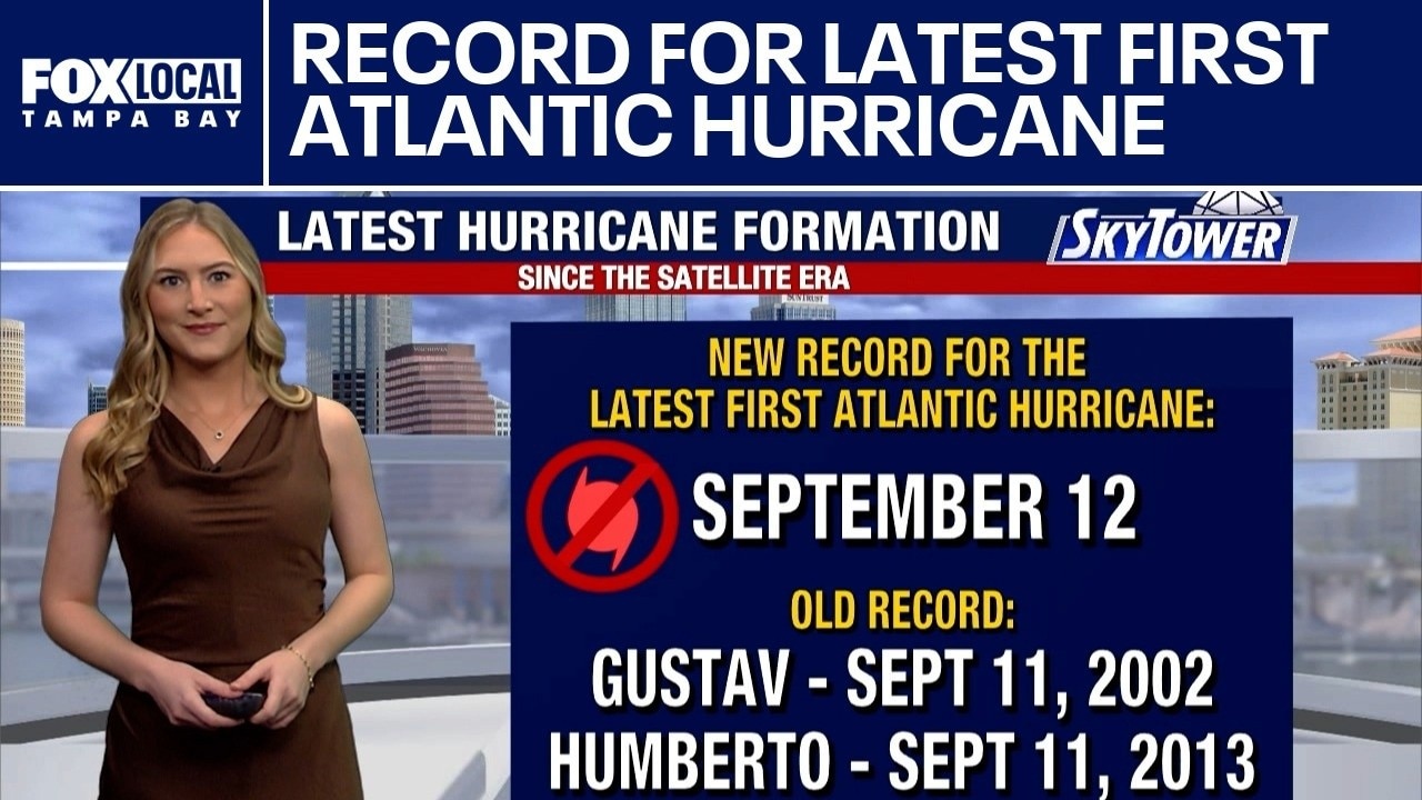
FOX 13 Meteorologist Valerie Mills explains how a new record has been set for the latest first hurricane in the Atlantic.
FOX 13 Meteorologist Valerie Mills explains how a new record has been set for the latest first hurricane in the Atlantic.

Atlantic hurricane season sets new record
FOX 13 Meteorologist Jim Weber is keeping an eye on a quiet tropics. He says this is the latest that we’ll see a hurricane form in the season. He added that a hurricane won’t be forming any time soon. Weber said that rain chances across the Bay Area will drop next week and there is no tropical formation expected.
FOX 13 Meteorologist Jim Weber is keeping an eye on a quiet tropics. He says this is the latest that we’ll see a hurricane form in the season. He added that a hurricane won’t be forming any time soon. Weber said that rain chances across the Bay Area will drop next week and there is no tropical formation expected.

Silence in the Atlantic
FOX 13 Meteorologist Dave Osterberg explains that it has been 314 days since we have had a hurricane in the tropical Atlantic Basin. The most recent being Hurricane Melissa on Oct. 31st, 2025.
FOX 13 Meteorologist Dave Osterberg explains that it has been 314 days since we have had a hurricane in the tropical Atlantic Basin. The most recent being Hurricane Melissa on Oct. 31st, 2025.

Stillness in the Atlantic
FOX 13 Meteorologist Dave Osterberg talks about how the tropics are remaining surprisingly quiet despite reaching the statistical peak of the Atlantic hurricane season.
FOX 13 Meteorologist Dave Osterberg talks about how the tropics are remaining surprisingly quiet despite reaching the statistical peak of the Atlantic hurricane season.
Atlantic stays quiet, could it break a record?
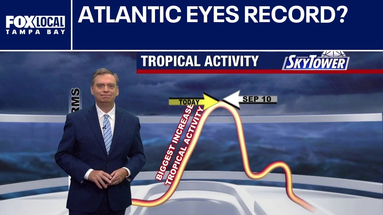
FOX 13 Meteorologist Jim Weber is tracking an unusually quiet stretch just days ahead of the climatological peak of hurricane season, thanks in large part to a combination of Saharan dust and strong wind shear associated with El Niño. No tropical formation is expected over the next seven days. The latest a hurricane has formed in the Atlantic during the satellite era is Sept. 11, according to historical records. If no hurricane develops before then, that record could be broken.
FOX 13 Meteorologist Jim Weber is tracking an unusually quiet stretch just days ahead of the climatological peak of hurricane season, thanks in large part to a combination of Saharan dust and strong wind shear associated with El Niño. No tropical formation is expected over the next seven days. The latest a hurricane has formed in the Atlantic during the satellite era is Sept. 11, according to historical records. If no hurricane develops before then, that record could be broken.
Hurricane Lowell nears western Hawaii
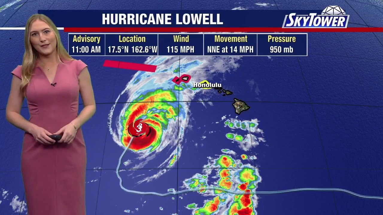
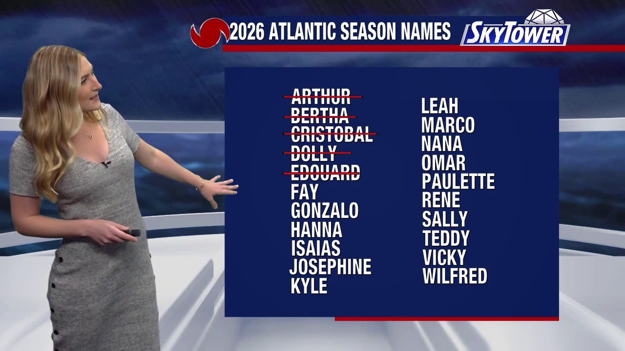
FOX 13 Meteorologist Valerie Mills is monitoring a hurricane warning for the islands of Kauai and Niihau. We are tracking Hurricane Lowell, which is making a very close pass to the western islands. The storm will be impactful over the next 24 to 48 hours. Lowell, a Category 2 hurricane, does not appear likely to make landfall. The storm will bring rounds of heavy rainfall, while hurricane-force winds will need to be monitored near the islands, including Honolulu. As we near the peak of hurricane season, the next name on the 2026 Atlantic storm list is Fay.
FOX 13 Meteorologist Valerie Mills is monitoring a hurricane warning for the islands of Kauai and Niihau. We are tracking Hurricane Lowell, which is making a very close pass to the western islands. The storm will be impactful over the next 24 to 48 hours. Lowell, a Category 2 hurricane, does not appear likely to make landfall. The storm will bring rounds of heavy rainfall, while hurricane-force winds will need to be monitored near the islands, including Honolulu. As we near the peak of hurricane season, the next name on the 2026 Atlantic storm list is Fay.
Quiet in the Atlantic
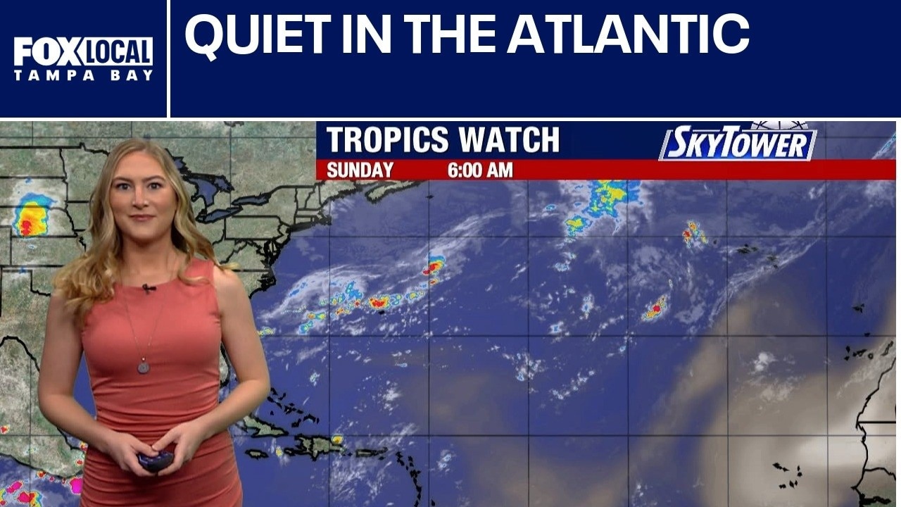
FOX 13 Meteorologist Valerie Mills explains how we are about a week away from the official peak of hurricane season, and for the third year in a row, we are not tracking any hurricanes or tropical systems. We are on our way to setting a record in the Atlantic basin for the latest hurricane formation.
FOX 13 Meteorologist Valerie Mills explains how we are about a week away from the official peak of hurricane season, and for the third year in a row, we are not tracking any hurricanes or tropical systems. We are on our way to setting a record in the Atlantic basin for the latest hurricane formation.
Latest first hurricane?
FOX 13 Meteorologist Valerie Mills says the tropics are on snooze. She explains how we could be approaching a record for the latest first hurricane formation if no storm forms by Sept. 11.
FOX 13 Meteorologist Valerie Mills says the tropics are on snooze. She explains how we could be approaching a record for the latest first hurricane formation if no storm forms by Sept. 11.
Quiet Atlantic, active Pacific
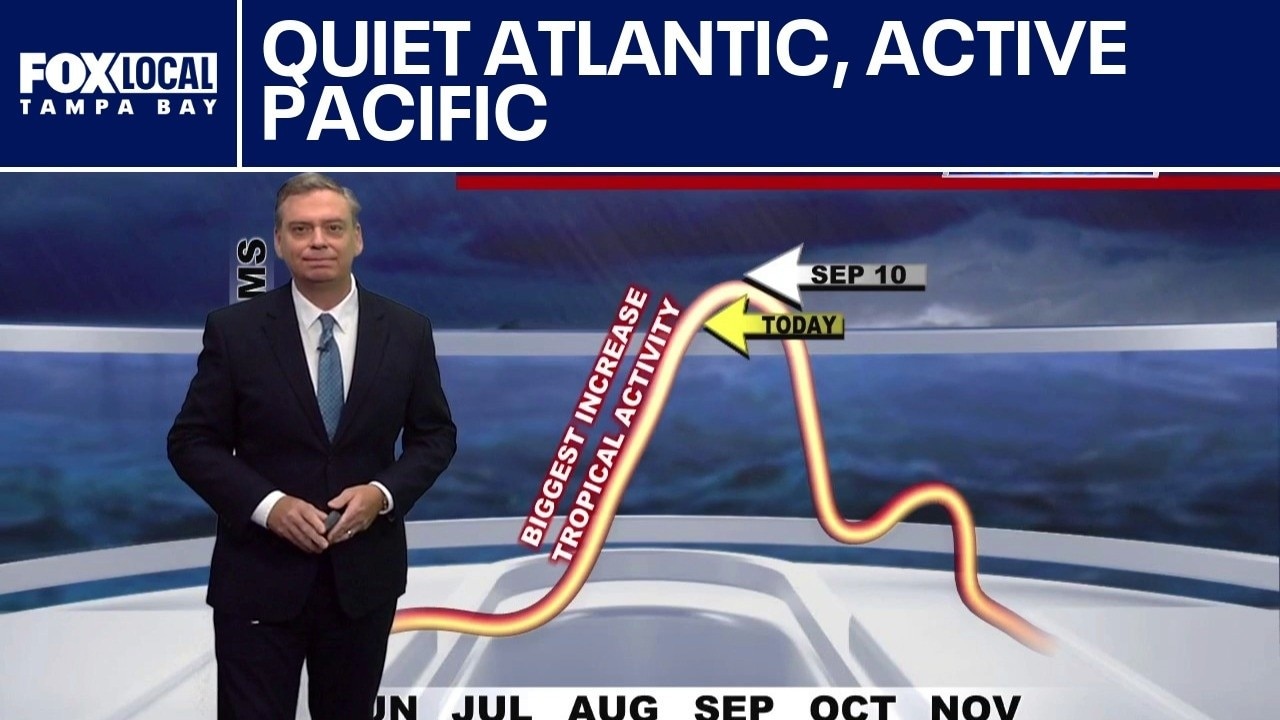
FOX 13 Meteorologist Dave Osterberg talks about how we are just one week away from the peak of the hurricane season, which is September 10th, and the Atlantic Basin is incredibly quiet. The massive wind shear created by the raging El Niño has basically shut down the Atlantic. Typically, it does slow down the Atlantic, but Eastern Pacific activity increase. There are three hurricanes in the Eastern Pacific right now, with the strongest one, Lowell, perhaps threatening Hawaii early next week.
FOX 13 Meteorologist Dave Osterberg talks about how we are just one week away from the peak of the hurricane season, which is September 10th, and the Atlantic Basin is incredibly quiet. The massive wind shear created by the raging El Niño has basically shut down the Atlantic. Typically, it does slow down the Atlantic, but Eastern Pacific activity increase. There are three hurricanes in the Eastern Pacific right now, with the strongest one, Lowell, perhaps threatening Hawaii early next week.
Today's tropical weather forecast
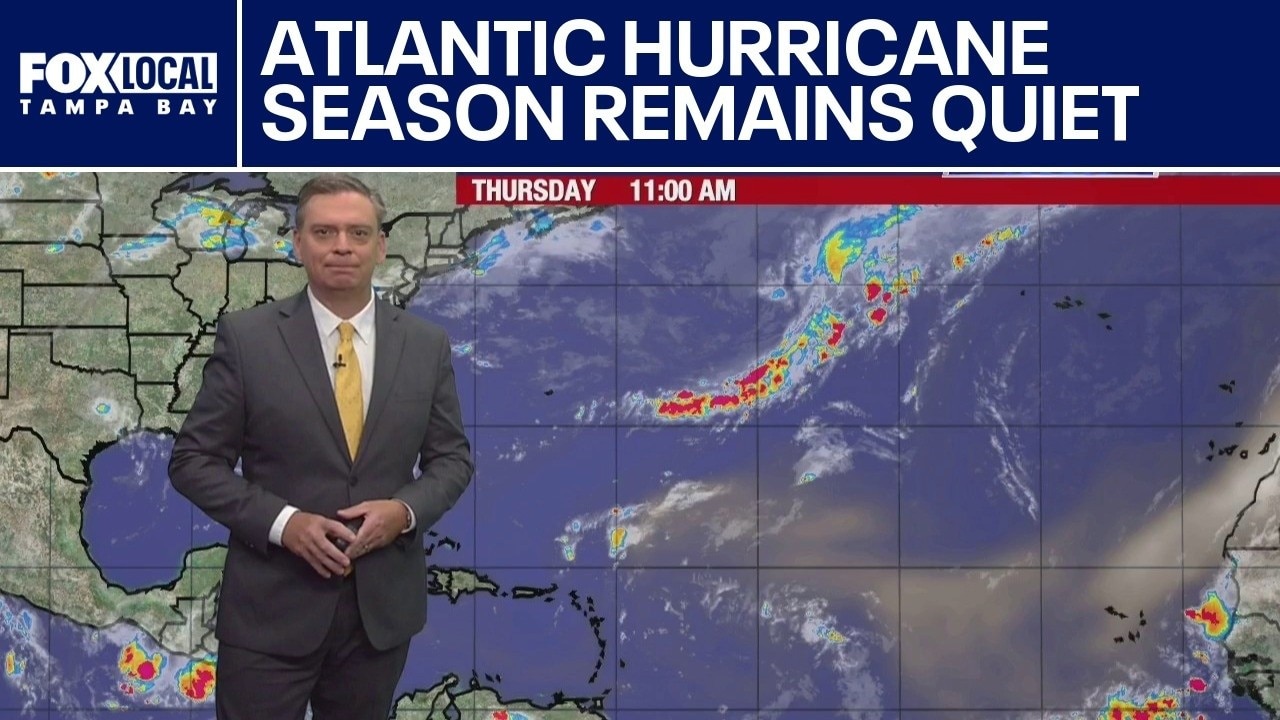
The Atlantic Basin remains unusually quiet as the peak of the 2026 hurricane season approaches, while tropical activity has surged in the Eastern and Central Pacific.
The Atlantic Basin remains unusually quiet as the peak of the 2026 hurricane season approaches, while tropical activity has surged in the Eastern and Central Pacific.
Heavy rain follows Tropical Depression Edouard
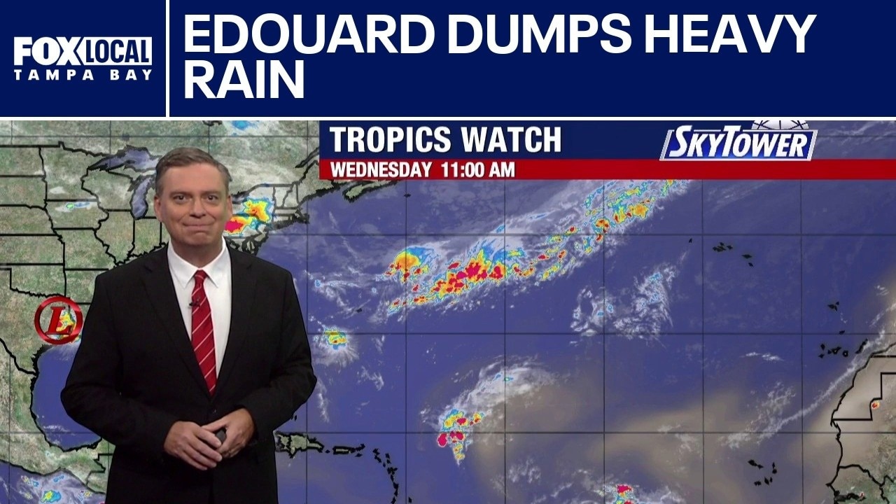
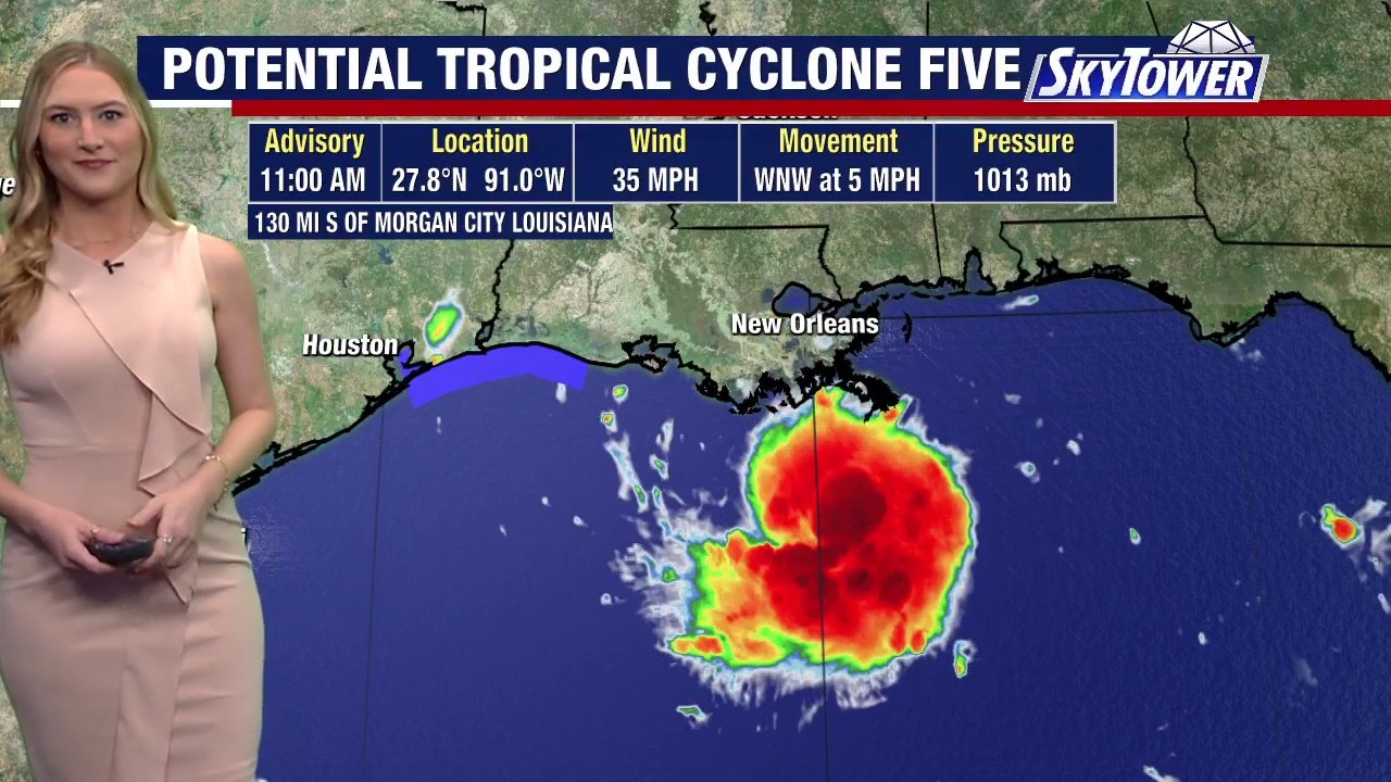
FOX 13 Meteorologist Dave Osterberg talks about how Tropical Depression Edouard continues to dump very heavy rain in Texas. After making landfall as a 60 mph tropical storm, it's winds are no longer a factor, but the rain is.
FOX 13 Meteorologist Dave Osterberg talks about how Tropical Depression Edouard continues to dump very heavy rain in Texas. After making landfall as a 60 mph tropical storm, it's winds are no longer a factor, but the rain is.
Tropical Storm Edouard strengthens
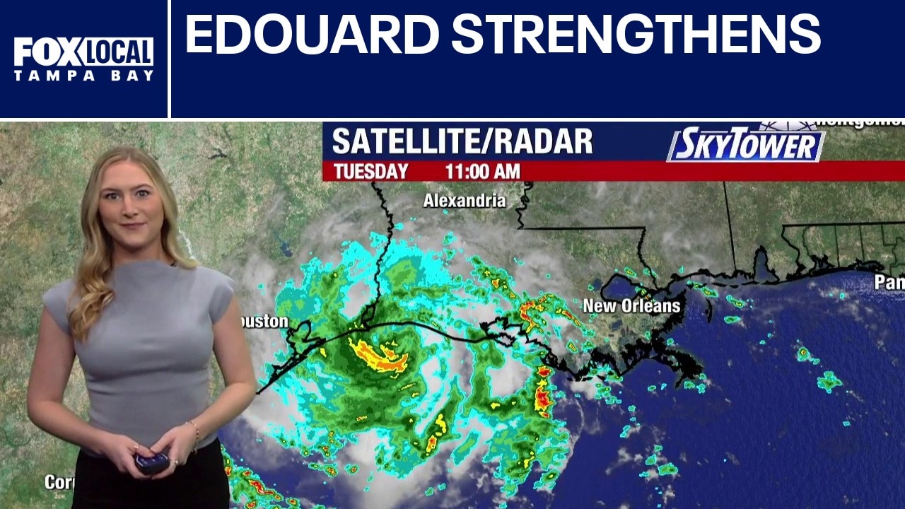
FOX 13 Meteorologist Valerie Mills is tracking Tropical Storm Edouard and its impacts across parts of Texas and Louisiana. Edouard has been strengthening, with maximum sustained winds near 50 mph. Winds just south of the storm’s center have been reported closer to 65 mph. There is still a chance Edouard could strengthen further before making landfall later Tuesday. A hurricane watch is in effect from High Island, Texas, to Cameron, Louisiana, where hurricane-force winds are possible. However, because of the storm’s small size, overall impacts are expected to remain relatively limited. Heavy rainfall will likely be the biggest concern, with the potential for flash flooding across parts of Texas and Louisiana. Edouard is expected to weaken quickly after moving inland. The next name on the Atlantic hurricane season list is Fay. As we approach the peak of hurricane season on Sept. 10, the rest of the tropics remain relatively quiet.
FOX 13 Meteorologist Valerie Mills is tracking Tropical Storm Edouard and its impacts across parts of Texas and Louisiana. Edouard has been strengthening, with maximum sustained winds near 50 mph. Winds just south of the storm’s center have been reported closer to 65 mph. There is still a chance Edouard could strengthen further before making landfall later Tuesday. A hurricane watch is in effect from High Island, Texas, to Cameron, Louisiana, where hurricane-force winds are possible. However, because of the storm’s small size, overall impacts are expected to remain relatively limited. Heavy rainfall will likely be the biggest concern, with the potential for flash flooding across parts of Texas and Louisiana. Edouard is expected to weaken quickly after moving inland. The next name on the Atlantic hurricane season list is Fay. As we approach the peak of hurricane season on Sept. 10, the rest of the tropics remain relatively quiet.
Today's tropical weather forecast
Today's tropical weather forecast
Today's tropical weather forecast

Watching 2 areas of development in Gulf, Caribbean
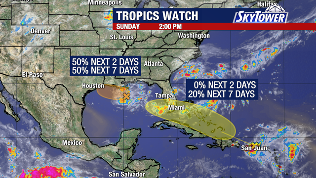
Meteorologists are closely tracking two tropical disturbances—Invest 97L in the northern Gulf of Mexico and the remnants of former Tropical Storm Dolly in the Caribbean—for signs of organization over the coming days.
Meteorologists are closely tracking two tropical disturbances—Invest 97L in the northern Gulf of Mexico and the remnants of former Tropical Storm Dolly in the Caribbean—for signs of organization over the coming days.
Dolly remnants, Gulf low being monitored
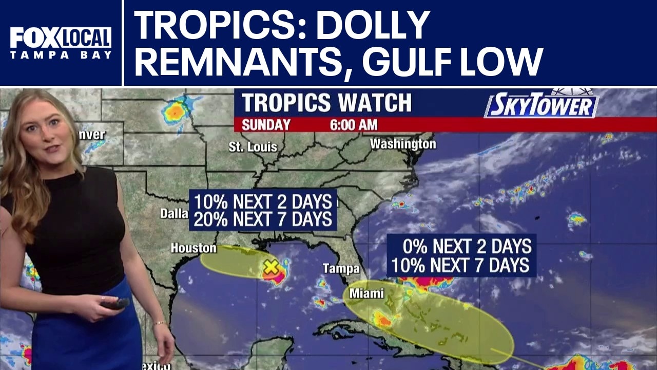
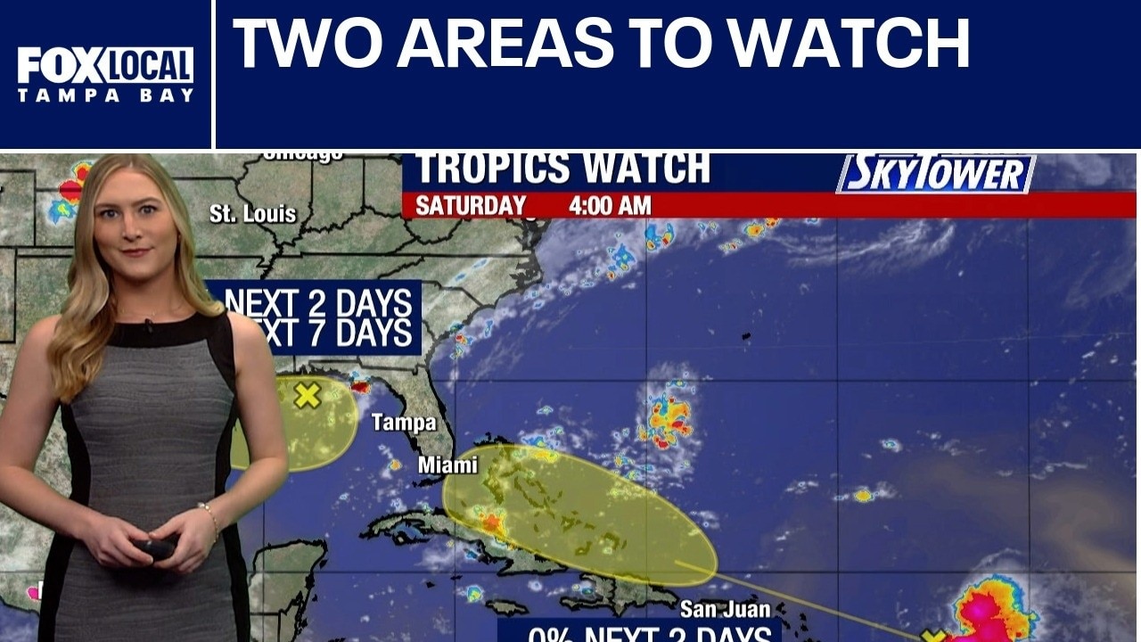
Two areas of interest are being monitored in the tropics. The first is a weak area of low pressure in the northern Gulf of Mexico. It has a 10% chance of tropical development over the next two days and a 20% chance over the next seven days. The remnants of what was Tropical Storm Dolly are also continuing to bring impacts to parts of the Caribbean. Heavy rain and strong winds are affecting areas including the Leeward Islands, Puerto Rico and the U.S. Virgin Islands. The system is generally moving toward the Bahamas, where there is a low-end chance it could reorganize over the next several days. Forecasters give it a 10% chance of redeveloping into next week. Meanwhile, the weak low pressure system in the Gulf is drifting westward and is centered just off the coast of New Orleans, Louisiana. The system is expected to bring additional rounds of rain to parts of the Deep South as it meanders along the northern Gulf. The next name on the 2026 Atlantic hurricane season list is Edouard.
Two areas of interest are being monitored in the tropics. The first is a weak area of low pressure in the northern Gulf of Mexico. It has a 10% chance of tropical development over the next two days and a 20% chance over the next seven days. The remnants of what was Tropical Storm Dolly are also continuing to bring impacts to parts of the Caribbean. Heavy rain and strong winds are affecting areas including the Leeward Islands, Puerto Rico and the U.S. Virgin Islands. The system is generally moving toward the Bahamas, where there is a low-end chance it could reorganize over the next several days. Forecasters give it a 10% chance of redeveloping into next week. Meanwhile, the weak low pressure system in the Gulf is drifting westward and is centered just off the coast of New Orleans, Louisiana. The system is expected to bring additional rounds of rain to parts of the Deep South as it meanders along the northern Gulf. The next name on the 2026 Atlantic hurricane season list is Edouard.
Two areas to watch
FOX 13 Meteorologist Valerie Mills explains how we have two areas we are watching, though the odds of tropical development are low. The remnants of Dolly are expected to bring heavy rain to places like Puerto Rico, the U.S. Virgin Islands and the Lesser Antilles.
FOX 13 Meteorologist Valerie Mills explains how we have two areas we are watching, though the odds of tropical development are low. The remnants of Dolly are expected to bring heavy rain to places like Puerto Rico, the U.S. Virgin Islands and the Lesser Antilles.
Today's tropical weather forecast
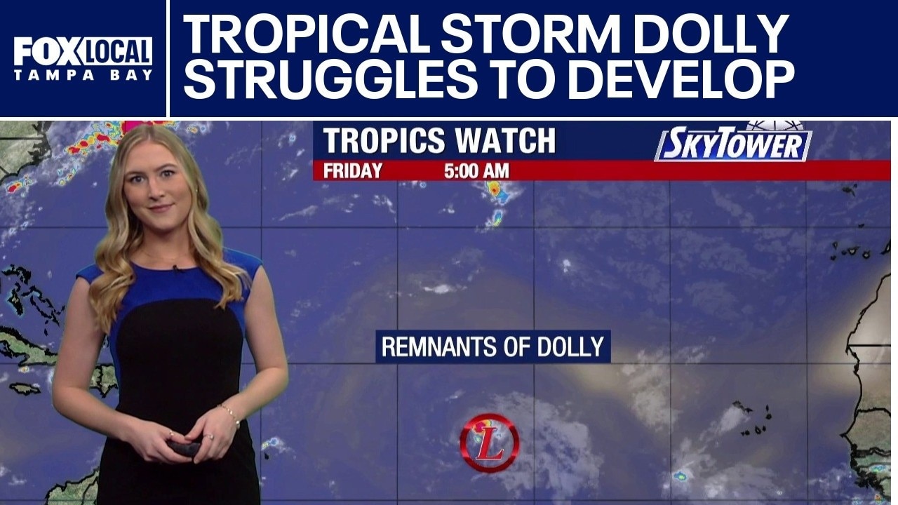
FOX 13 Meteorologist Valerie Mills explains how Tropical Storm Dolly is moving briskly toward the Leeward Islands while struggling against unfavorable atmospheric conditions.
FOX 13 Meteorologist Valerie Mills explains how Tropical Storm Dolly is moving briskly toward the Leeward Islands while struggling against unfavorable atmospheric conditions.

Heavy rain leftover from Dolly brings rain to Leeward Islands
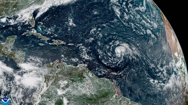
Tropical Storm Dolly is no more. The National Hurricane Center said Friday that Dolly had been downgraded to an open tropical wave as it makes its way across the Atlantic Ocean, towards the Leeward Islands. Tropical Storm Dolly Leeward Islands.
Tropical Storm Dolly is no more. The National Hurricane Center said Friday that Dolly had been downgraded to an open tropical wave as it makes its way across the Atlantic Ocean, towards the Leeward Islands. Tropical Storm Dolly Leeward Islands.

Tropical Storm Dolly forms in the Atlantic, 4th storm of the season
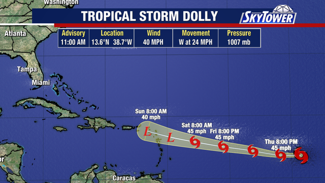
Tropical Storm Dolly formed early Thursday morning over the central tropical Atlantic, becoming the fourth named storm of the 2026 Atlantic hurricane season, the National Hurricane Center said.
Tropical Storm Dolly formed early Thursday morning over the central tropical Atlantic, becoming the fourth named storm of the 2026 Atlantic hurricane season, the National Hurricane Center said.
Wind shear impacting 2 Atlantic systems
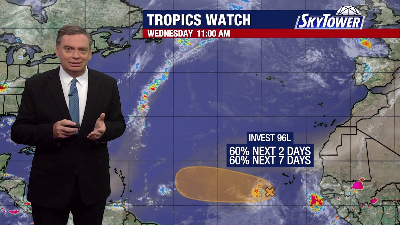
FOX 13 Meteorologist Jim Weber is still watching Invest 95L, which has been sheared away as it works its way north in the Atlantic. He said there is no concern about it. Weber is also keeping an eye on Invest 96L, which has a 60% chance of developing over the next week. Computer models show it moving west in the Atlantic, but Weber said it will encounter wind shear and will start to fall apart over the weekend. The next name on the list is Dolly.
FOX 13 Meteorologist Jim Weber is still watching Invest 95L, which has been sheared away as it works its way north in the Atlantic. He said there is no concern about it. Weber is also keeping an eye on Invest 96L, which has a 60% chance of developing over the next week. Computer models show it moving west in the Atlantic, but Weber said it will encounter wind shear and will start to fall apart over the weekend. The next name on the list is Dolly.