Invest 91L has high chance of development in the Gulf of Mexico
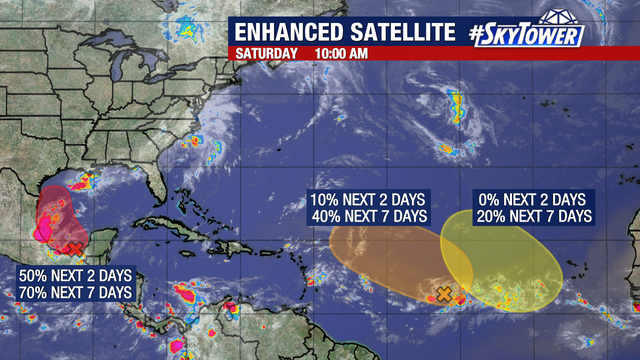
There is now a high chance of development for an area of low pressure (Invest 91L) that has formed over the Bay of Campeche.
There is now a high chance of development for an area of low pressure (Invest 91L) that has formed over the Bay of Campeche.
Invest 91L now 'likely' to form tropical depression in Gulf of Mexico next week
Tropical disturbance 91L now is "likely" to become at least a tropical depression or perhaps even Tropical Storm Francine during the early to middle part of next week as it slides into the southwestern Gulf of Mexico.
Tropical disturbance 91L now is "likely" to become at least a tropical depression or perhaps even Tropical Storm Francine during the early to middle part of next week as it slides into the southwestern Gulf of Mexico.
Disturbance could become next tropical storm
FOX 13 News Meteorologist Valerie Mills says there are two area of interest in the Atlantic. One disturbance over the Bay of Campeche has a 40% chance of developing in the next two days and a 60% chance over the next week. Mills says the other area being monitored only has a 30% chance for development in the next seven days.
FOX 13 News Meteorologist Valerie Mills says there are two area of interest in the Atlantic. One disturbance over the Bay of Campeche has a 40% chance of developing in the next two days and a 60% chance over the next week. Mills says the other area being monitored only has a 30% chance for development in the next seven days.
Tracking the tropics | NHC monitoring several systems
FOX 13 meteorologist Jim Weber is tracking the tropics and lets us know if Florida will be impacted by any storms anytime soon.
FOX 13 meteorologist Jim Weber is tracking the tropics and lets us know if Florida will be impacted by any storms anytime soon.
New tropical disturbance off Texas coast among 5 being tracked for development
FOX 13 meteorologist Jim Weber is tracking the very active tropics.
FOX 13 meteorologist Jim Weber is tracking the very active tropics.
NHC tracking three waves in the Atlantic
FOX 13 meteorologist Jim Weber has the latest on the tropics.
FOX 13 meteorologist Jim Weber has the latest on the tropics.
Multiple disturbances in Atlantic
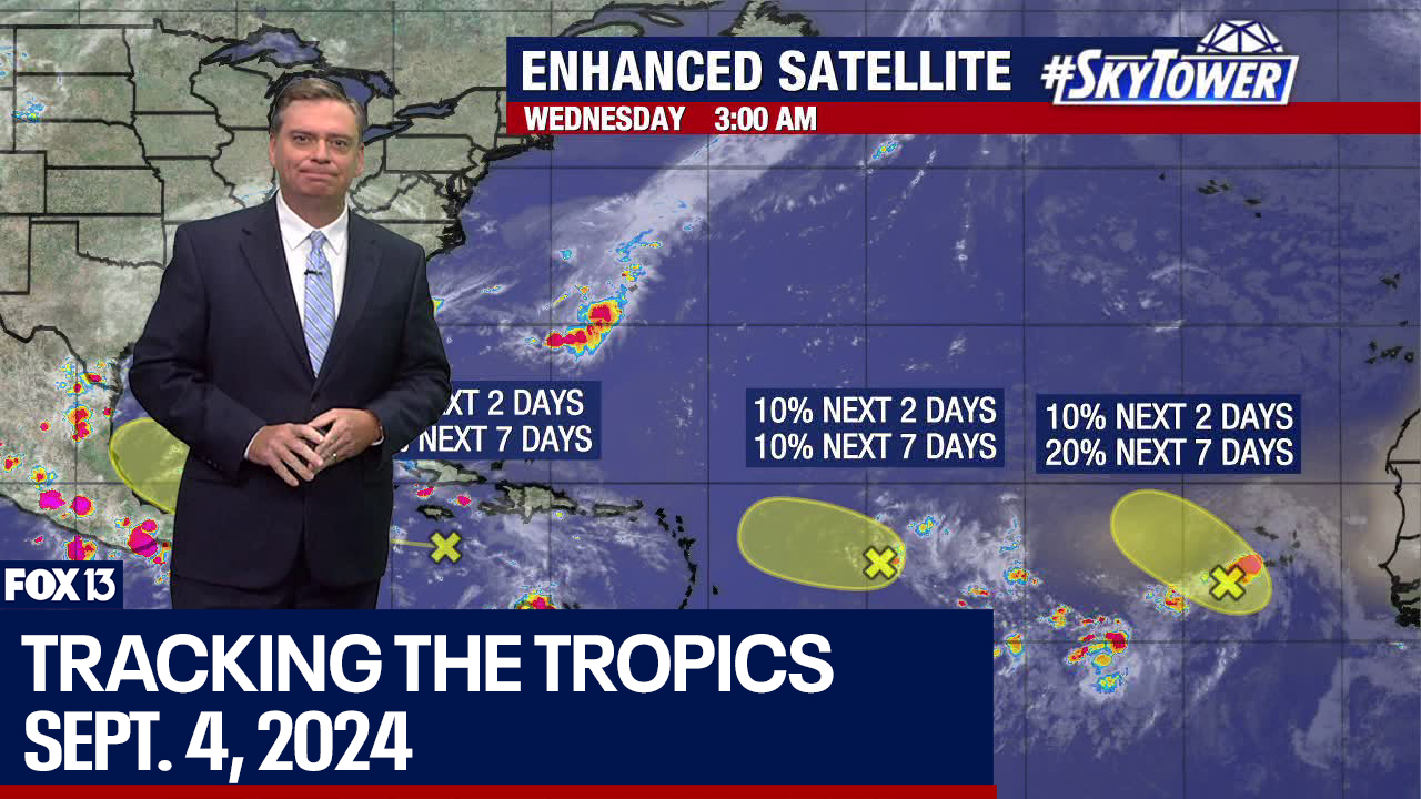
FOX 13 News Meteorologist Jim Weber says three disturbances in the Atlantic don't have a high chance of development over the next couple of days but two have a 40% chance of development over the next week.
FOX 13 News Meteorologist Jim Weber says three disturbances in the Atlantic don't have a high chance of development over the next couple of days but two have a 40% chance of development over the next week.
3 tropical waves being monitored in Atlantic
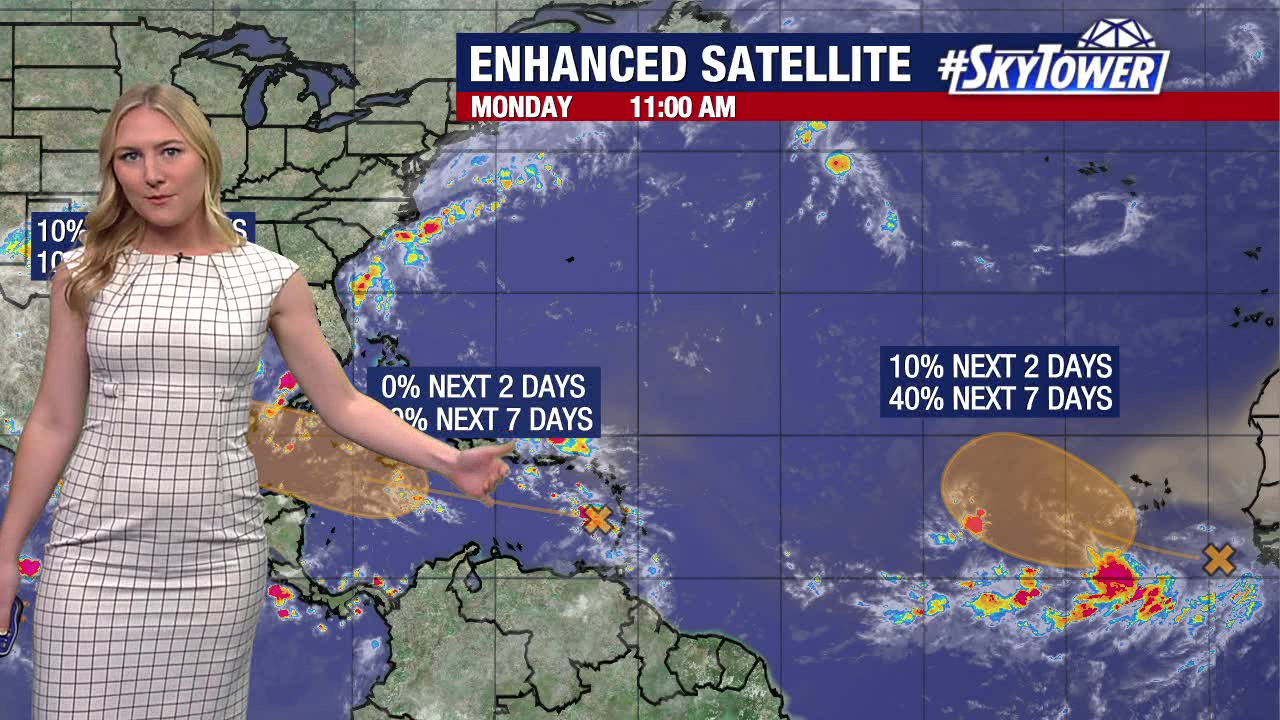
FOX 13 News Meteorologist Valerie Mills says two of the waves have a 40% chance of development over the next seven days. One wave near Texas only has a 10% chance of development over the next week, according to Mills.
FOX 13 News Meteorologist Valerie Mills says two of the waves have a 40% chance of development over the next seven days. One wave near Texas only has a 10% chance of development over the next week, according to Mills.
NHC monitoring 3 disturbances in Atlantic, 2 have medium chance of development
The National Hurricane Center is monitoring three areas in the Atlantic for development chances.
The National Hurricane Center is monitoring three areas in the Atlantic for development chances.
NHC tracking three tropical waves, one bringing heavy rain to Gulf Coast
The National Hurricane Center is watching three disturbances in the tropics, including one that could soon develop and another that's bringing heavy rain to the Gulf Coast.
The National Hurricane Center is watching three disturbances in the tropics, including one that could soon develop and another that's bringing heavy rain to the Gulf Coast.
NHC keeping an eye on 3 areas in the tropics
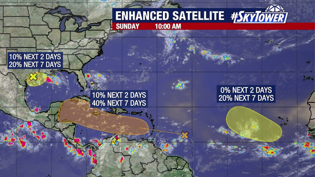
FOX 13 meteorologist Valerie Mills says there are three systems in the tropics with chances of development. One has a 40 percent chance in the next seven days as it heads into the Caribbean Sea. Another is already dumping heavy rain along a stretch of the U.S. Gulf Coast.
FOX 13 meteorologist Valerie Mills says there are three systems in the tropics with chances of development. One has a 40 percent chance in the next seven days as it heads into the Caribbean Sea. Another is already dumping heavy rain along a stretch of the U.S. Gulf Coast.
NHC monitoring three waves in the tropics this Labor Day weekend
The National Hurricane Center says it's watching three disturbances as we near the peak of the Atlantic hurricane season.
The National Hurricane Center says it's watching three disturbances as we near the peak of the Atlantic hurricane season.
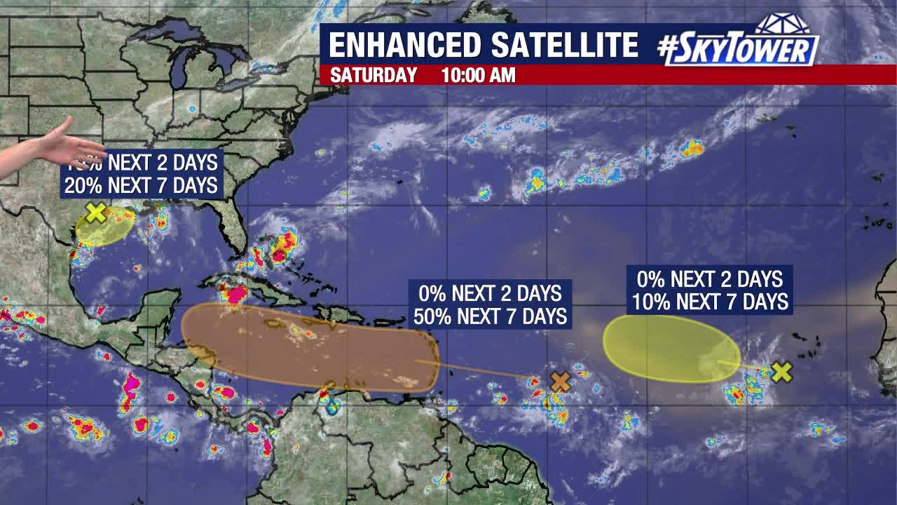
NHC watching three systems with chances of development
FOX 13 meteorologist Valerie Mills says there are three areas of interest in the tropics. One in the Gulf of Mexico has a slight chance to develop, while another that's expected to move into the Caribbean Sea has a 50 percent chance in the next week. A third wave off the coast of Africa has a small chance to soon develop, as well.
FOX 13 meteorologist Valerie Mills says there are three areas of interest in the tropics. One in the Gulf of Mexico has a slight chance to develop, while another that's expected to move into the Caribbean Sea has a 50 percent chance in the next week. A third wave off the coast of Africa has a small chance to soon develop, as well.
Tropical activity picks back up, NHC monitoring two waves with chances of development
The National Hurricane Center is keeping an eye on two separate disturbances in the Atlantic that could develop by next week.
The National Hurricane Center is keeping an eye on two separate disturbances in the Atlantic that could develop by next week.
NHC monitoring two waves with chances of development
FOX 13 meteorologist Jim Weber is tracking the tropics as we head into the holiday weekend.
FOX 13 meteorologist Jim Weber is tracking the tropics as we head into the holiday weekend.
Tropical disturbance in Atlantic gets increased development odds as second one emerges
The National Hurricane Center is watching a disturbance in the Atlantic that could develop in the next several days.
The National Hurricane Center is watching a disturbance in the Atlantic that could develop in the next several days.
Tropics becoming active as we approach peak of hurricane season
FOX 13 meteorologist Jim Weber is tracking the tropics. Things are starting to get more active in the Atlantic.
FOX 13 meteorologist Jim Weber is tracking the tropics. Things are starting to get more active in the Atlantic.
Tropics getting more active
FOX 13 meteorologist Jim Weber is tracking the tropics.
FOX 13 meteorologist Jim Weber is tracking the tropics.
Potential tropical disturbance pops up in Atlantic
FOX 13 Meteorologist Valerie Mills broke down an area of interest in the Atlantic that the National Hurricane Center is now monitoring. She said higher-than-normal water temps could lead to development. She also broke down some activity in the Pacific.
FOX 13 Meteorologist Valerie Mills broke down an area of interest in the Atlantic that the National Hurricane Center is now monitoring. She said higher-than-normal water temps could lead to development. She also broke down some activity in the Pacific.
Tropics may heat up when Saharan dust breaks up
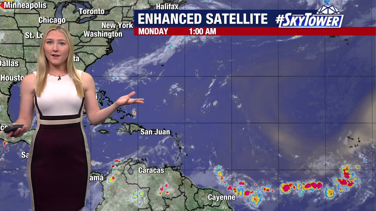
FOX 13 Meteorologist Valerie Mills is keeping an eye on the tropics, which are expected to remain quiet over the next seven days thanks to a layer of Saharan air. Mills says the Saharan air layer, which is 50 % drier than the typical air, makes it difficult for a tropical system to develop. However, once that dust breaks down, the Atlantic waters will be about 3-5 degrees warmer than normal, and Mills says that will offer up a lot of fuel for storms. The next named storm in the Atlantic will be Francine. Mills noted that while the Atlantic is quiet, the Pacific is active, with three named storms swirling as La Nine begins to emerge.
FOX 13 Meteorologist Valerie Mills is keeping an eye on the tropics, which are expected to remain quiet over the next seven days thanks to a layer of Saharan air. Mills says the Saharan air layer, which is 50 % drier than the typical air, makes it difficult for a tropical system to develop. However, once that dust breaks down, the Atlantic waters will be about 3-5 degrees warmer than normal, and Mills says that will offer up a lot of fuel for storms. The next named storm in the Atlantic will be Francine. Mills noted that while the Atlantic is quiet, the Pacific is active, with three named storms swirling as La Nine begins to emerge.


